The Walls/ Las Murallas, Gates and More Sights of the Colonial Zone
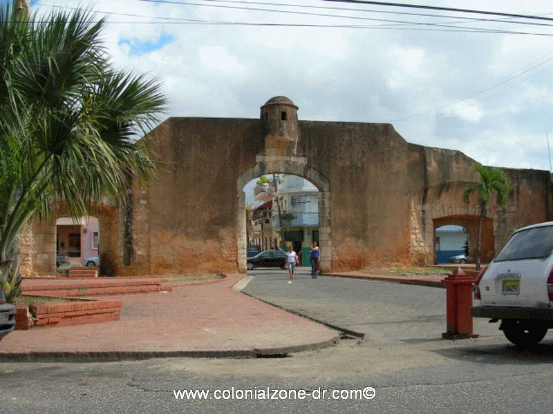
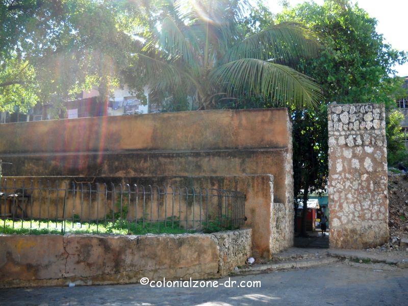
Puerta de la Misericordia/ Gate of Mercy
This lone wall was once a part of the original wall that ran from Puerta del Conde (Parque Independencia) all along the edge of the First City of the Americas. The Gate of Mercy gave protection and refuge to the colonists from natural disasters (hurricanes and earthquakes). Located in the park is a bust statue of Ramon Matias Mella who is one of the Founding Fathers of the country.
Directions: Calle Palo Hincado and Calle Arzobispo Portes see the map (number 72)
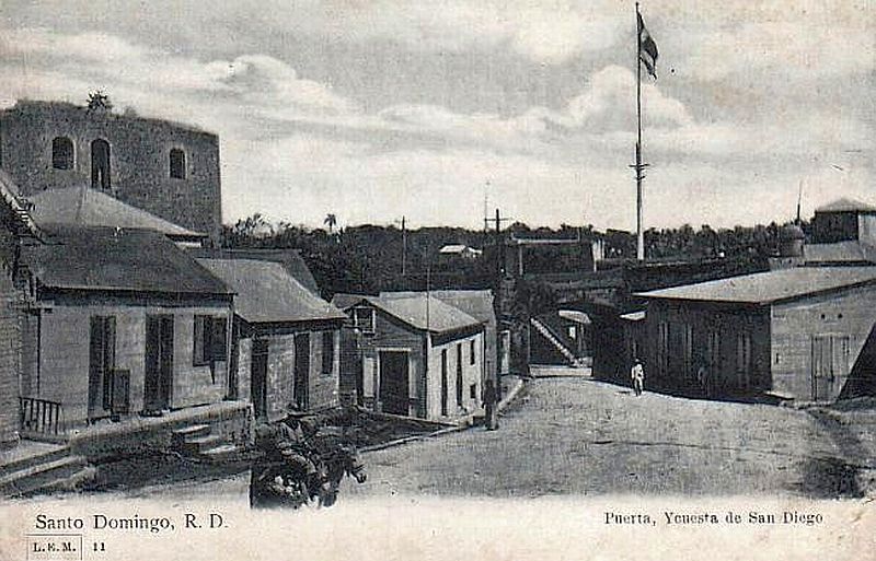
Puerta de San Diego/ Gate of St. James
On the grounds of the Alcázar is located the Puertas de San Diego also called Puerta de la Mar/The Door of the Sea. This gate is the original gate of the original old city built in 1549 as protection for the city against an attack coming from the river.
Directions: Av del Puerto at the entrance of Plaza Espańa. see the map (number 36)
Fuerte de San José/ The Fort of San Jose
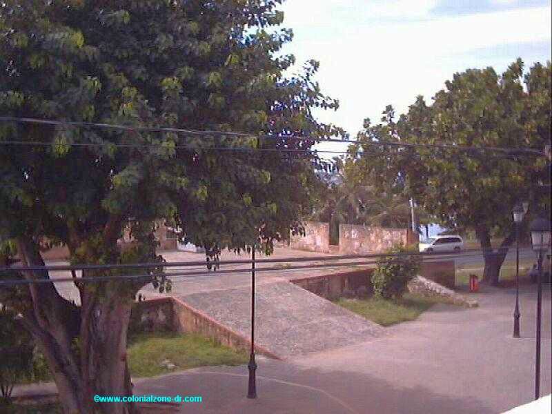
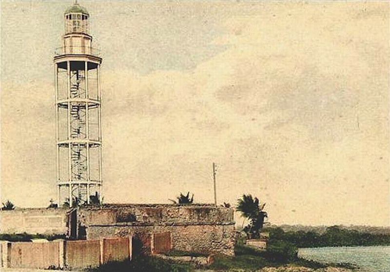
This was one of the first strong holds of the walled city in the 16th century. Construction began in the mid 1500's taking over 2 centuries to complete. This fort was part of a series of bastions built to defend the city of Santo Domingo which is what the Colonial City was called at that time. This fort, with it's walls, was built at the mouth of the Rio Ozama. It's purpose was to watch the comings and goings at this strategic point of the city. The equipped artillery platform, with it's two look out points and cannons was part of the walls that surrounded the city. There was also a lighthouse located here at the entrance to the Rio Ozama. One must remember that the road in the front of the fort did not exist at that time. The water came up to the walls.
The walls were built first by president Alonso de Fuenmayor who had some serious money problems and could not complete construction. Finally in the beginning of the 17th century the wall of this important fort were finished.
Now, from the elevated platform you can have a great view of the statue of Friar Anton de Montecino, the entrance to the river Ozama and the Light House now located farther out at the mouth of the river. More information about the park that is located here, Parque San Jose.
Directions: between Avenida George Washington (Paseo Presidente Billini) and Jose Gabriel Garcia and Calle 19 de Marzo, see the map (number 65)
Puerta de la Misericordia/ Gate of Mercy | Puerta de San Diego/ Gate of St. James | Puerta de las Atarazans | Bateria del Almirante/ Battery of the Admiral | Fuerte de la Carena | Fuerte de Angulo | Fuerte de San Anton | Fuerte de San Francisco | Fuerte de San Miguel | Fuerte de San Lazaro | Fuerte de la Caridad/ Fort of Charity | Fuerte de San José/ Fort of St. Jose | Fuerte Invencible | Puerta del Conde/ Door of the Count
Fuerte de la Caridad/ Fort of Charity
It is part of the northern section of the wall, built in the late seventeenth century. It can be seen in ruins hidden behind some buildings.
Directions: Juan Isidro Pérez #215 and Mella see the map (number 4)
Fuerte de San Lazaro
Constructed in the end of the 17th century using a pentagon shape. It is the only fort that has a strong double ramp leading up to the fort. .This is very unique and is the only stronghold that has this type of incline. More information about the Iglesia de San Lazaro
Directions: Juan Isidro Pérez coming in from Santomé and José Reyes see the map (number 7)
Fuerte de San Miguel
Located in front of the church of San Miguel. All that is left of this fort is a wall that is in bad decay
Directions: Juan Isidro Pérez and José Reyes see the map (number 12)
Fuerte de San Francisco
Located between the Forts of San Miguel and Ermita de San Antón, there is nothing left of this fort but a few small traces. Its wall, at one time, connected chapel or Ermita de San Antón and Ruins of the San Francisco Monistary. It is hidden behind homes now.
Directions: Duarte and Vicente Celestino Duarte and General Cabral see the map (number 21)
Fuerte de Angulo
This military station was originally named the Fuertecillo. When the highway was built much of this fort was lost. It was reconstructed in 1991 Next to this is the Ceiba de Colón.
The walls can be seen as you enter the Colonial Zone on Avenida del Puerto coming from the Airport across the bridge. It is quite amazing to view as you enter the city. Seeing these tall walls looming as you pass on the road. You can see the buildings sitting atop these walls. There can be no doubt that you have entered the Colonial Zone.
Directions: Avenida del Puerto and Juan Parra Alba see the map (number 23)
Fuerte de la Carena
This is a small rectangular bunker located to the north of Fuerte de Angulo dating back to 1543 This is part of the fort where boats were brought for repair. It was rebuilt on its original foundation in 1991.
Directions: Avenida del Puerto and General Cabral see the map (number 24)
Fuerte Invencible
Built in the 17th century it was part of the original estate of Dávila. The walls of this fort are visible when you are entering the Colonial City coming from the bridge across Rio Ozama. Sofitel Nicolas Ovando sits majestically atop this stronghold built with carved stone blocks and 12 pockets where guns could overlook the river entrance. .
Directions: Avenida del Puerto below Casa de Ovando see the map (number 39)
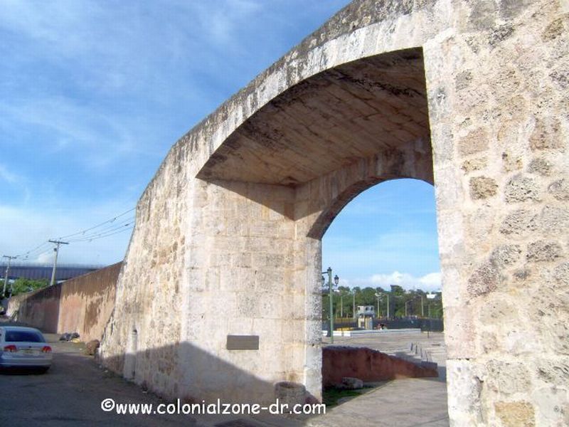
Puerta de las Atarazanas
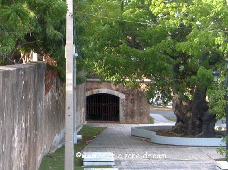
This was the door to the Atarazanas reconstructed in the 1970's.
Directions: Avenida del Puerto, Calle Colón and Las Atarazanas see the map (number 31)
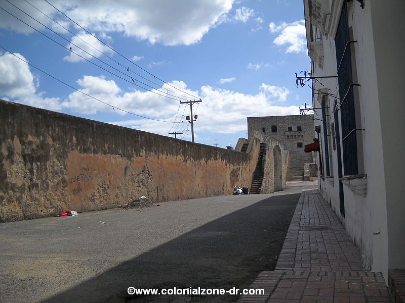
Bateria del Almirante/ Battery of the Admiral
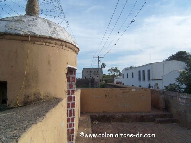
This was built as a double sided wall where one could walk the permitter of the Atarazanas and Alcazar de Colon on the side of the river. One must remember that the river came up very close to these walls. There was always activity and ships coming and going. This was the perfect vantage point to view all.
Directions: Avenida del Puerto at the foot of the Alcázar see the map (number 29)


Home | Dining & Night Life | Hotel | Sights | Pictures | Music | Colonial Zone Map | Hot Spots! Directory | Site Search


MENU
IN COLONIAL ZONE
THINGS DOMINICAN
If you found my web site useful please consider making a donation through Pay Pal . Thanks!

Our complete exchange rate tool.
Gracias a coinmill.com
Many of the Doors, Gates and Walls in the Colonial City were and still are gathering places for the Dominican people. Many I have included in the Fort or other areas that they are connected to.
+click image to enlarge
Puerta San Diego 1910 (note Alcazar de Colon on left)
+click image to enlarge
Puerta de las Atarazans
+click image to enlarge
Battery of the Admiral walkway atop the wall.
+click image to enlarge
Fuerte and Parque San Jose 2006 (top)
Fort and Faro (lighthouse) in the early 1900's(bottom)
+click image to enlarge
Fort Carena 2010 (top)
Fort Angulo 2010 (bottom)
Fuerte de San Anton
Designed by J. B. Ruggero in 1672, it is one of the seven bastions surrounding the city on the north. It was not in the best location at the bottom of a hill so it was rebuilt many times.
Directions: Hostos and General Cabral along Ave. Mella see the map (number 87)
+click image to enlarge
Fuerte San Anton wall

|
|

site map Copyright © 2005 - 2016 All Rights Reserved. Colonial Zone-Dominican Republic (DR)
Home | Calendar | Night Life/Dining | Sight Seeing | Pictures | Businesses | Artists | Food | Helps | History | Language | Music | Media | Pastimes | Products | Tradition/Legend | Links | About Us | Buy Mamajuana | News Blog | DR Gringa's Life Blog | Dominican Dog Blog

Custom Search
I moved this information to its very own page about Parque Independencia, Puerta del Conde and the Altar de la Patria. There are a few nice pictures also.

