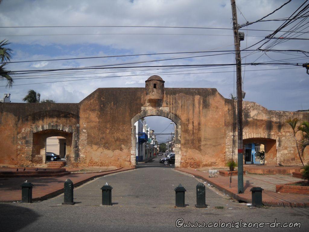
The Puerta de la Misericordia, originally named Puerta de Santiago and Puerta Grande, was the first fortified gate of the city of Santo Domingo. The lone wall was once part of the original wall that ran along the edge of the First city in the Americas, from Puerta del Conde (Parque Independencia) to Fuerte San Gil at the edge of the sea.
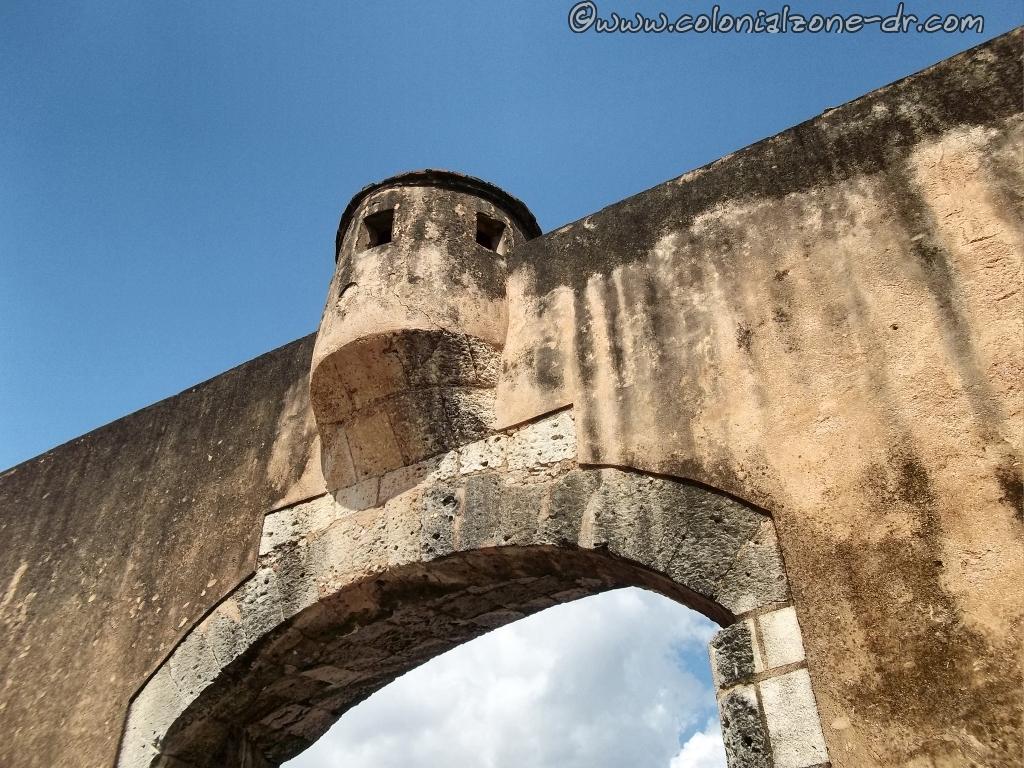
The door was designed by the architect Rodrigo de Liendo and constructed in 1543; the bulwarks were added in 1568. In the colonial period, the gate served as access to the great plains of the south. The wall was connected to and protected by the military of the Fuerte de San Gil which is located just a few hundred feet south at the shore of the Caribbean.
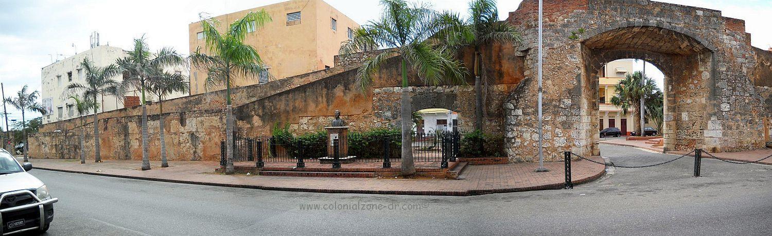
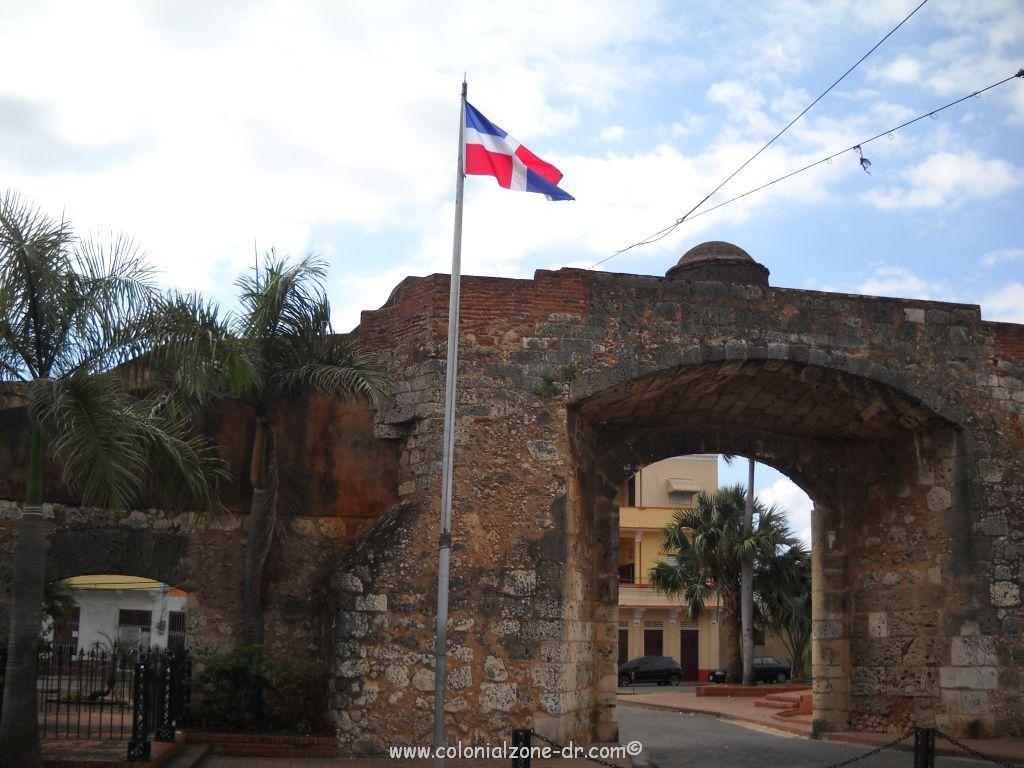
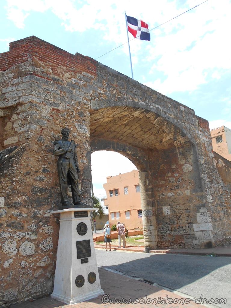
Puerta de la Misericordia panoramic with the flag of Dominican Republic flying proudly above.
The gate received its current name, Puerta Misericordia (Gate of Mercy), in 1842. At this time the survivors of the many earthquakes and storms that occurred on the island gathered here to place the Blessed Sacrament thanking God for his mercy.
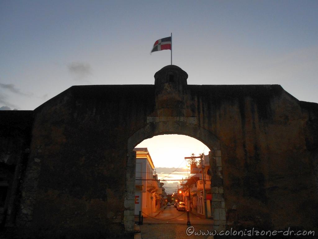
Puerta de la Misericordia in the early morning.
Announcing Independence February 27, 1844
The Puerta de la Misericordia is the place that Ramón Matías Mella fired his legendary blunderbuss (a muzzle-loading firearm) of February 27, 1844, to announce the independence of the Dominican Republic from Haiti after taking back the Fortaleza Ozama. At the same time of this shot, Francisco del Rosario Sanchez hoisted the Dominican flag in the Fortaleza.
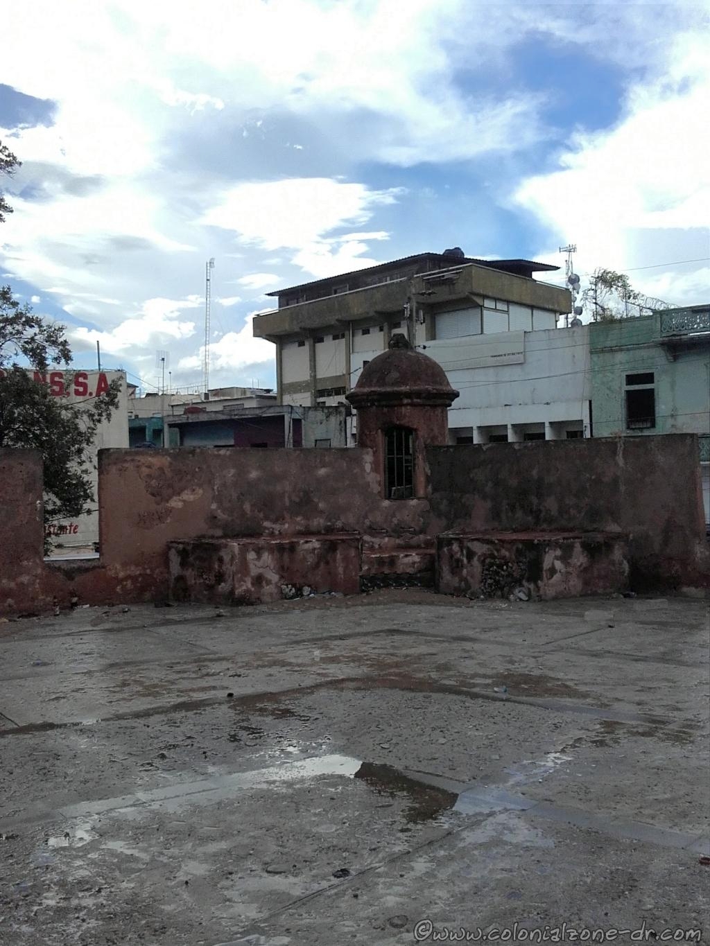
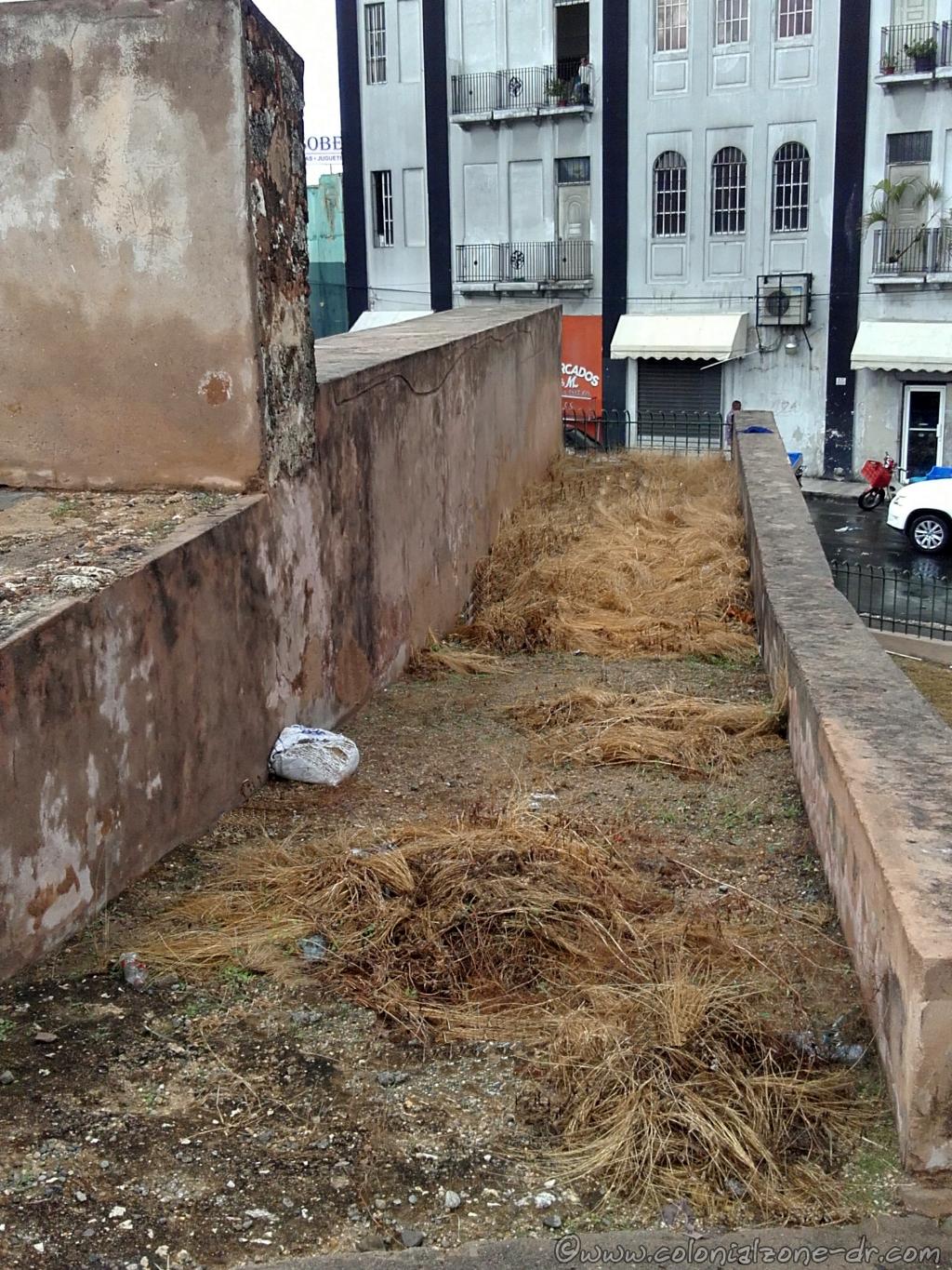
Puerta de la Misericordia look out tower accessed by the catwalk.
Interesting Facts
*Near the door is a courtyard that held a scaffold used to execute those who were condemned to death. At one time there was a small chapel located in the courtyard.
*During the archaeological excavations in 1980, two small fortines (semicircular forts) that once flanked the walls were discovered.
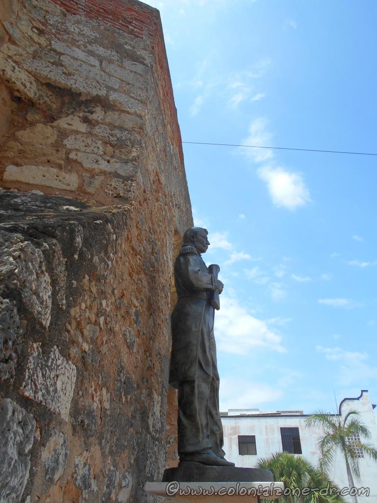
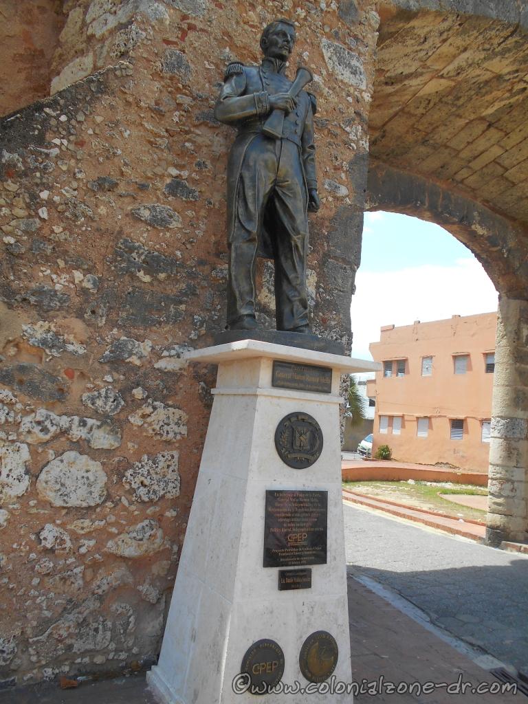
*Located in the small plaza is a statue of Ramón Matías Mella, one of the Founding Fathers of the country.
The statue of Ramón Matías Mella at the Puerta de la Misericordia
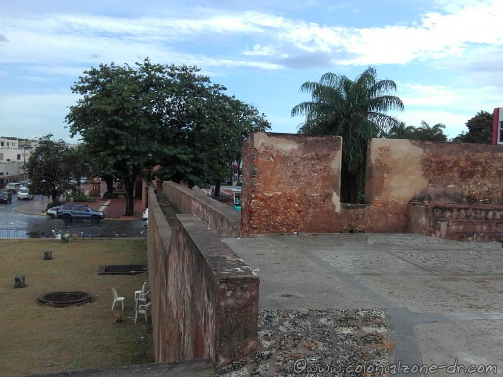
The area surrounding the gate is now a nice little place to visit. You can sit and enjoy the view of the Fort San Gil and the Caribbean Sea located across the Malecon. There is also a Colmado across the street where you can get a little refreshment after walking around the Colonial City. You can notice that there is a catwalk over the top of the wall but it is blocked. Some of the original wall has been cut to make room for the street to pass making accessing the walk difficult.
The view of the Gate of Mercy from Calle Padre Billini with Palo Hincado passing in front.
Directions:
From The Calle el Conde at Parque Independencia walk towards the sea on Calle Palo Hincado the street that separates Ciudad Colonial from Ciudad Nueva. Calle Arzobispo Portes stops at the door.
Plaza Patriótica at the Puerta de la Misericordia honoring General Matías Ramón Mella
The Statue of General Matías Ramón Mella
Plaza Patriótica / Patriotic Square
General Matías Ramón Mella
February 25, 1816 – June 4, 1864
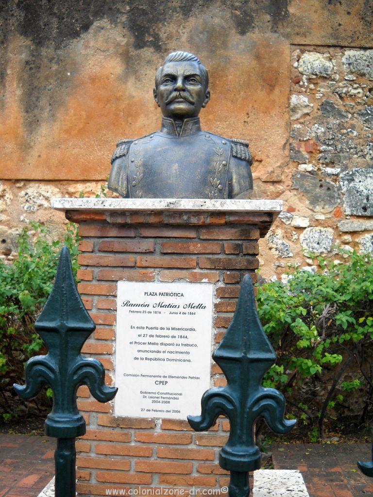
Located in front of Puerta Misericordia was a bust statue Ramón Matías Mella, one of the Founding Fathers of the Republica Dominicana. It was replaced with a full body statue honoring the anniversary of Mellas birth.
Close up of the statue honoring General Matías Ramón Mella
The plaque on the statue monument reads:
En homenaje al Padre de la Patria,
General Matías Ramón Mella
Héroe de la Independencia y de la
Restauración de la República Dominicana,
considerado el más grande genio y
estratega militar dominicano
de todos los tiempos.
Político liberal. Independentista eterno.
(English translation)
In homage to the Father of the Nation,
General Matías Ramón Mella
Hero of Independence and the
Restoration of the Dominican Republic,
considered the greatest genius and
Dominican military strategist
of all times.
Liberal politician. Eternal independence.
CPEP
Comision Permanente / Permanent Commission
From Efemerides Patrias
Proyecto Patriótico de Cultura Cívica / Patriotic Civic Culture Project
Foundación Luces y Sombras
Bicentenario de su natalicio / Bicentennial of his birth
25 Febrero 2016
Gobierno Constitucional
Lic. Danilo Medina Sánchez
2012-2016
The bust of General Matías Ramón Mella what was replaced by the statue.
The bust of Sanchez that was replaced by the statue read:
Gobierno Constitucional
Dr. Leonel Fernández
2004-2008
Fuerte de la Concepción was built later in the history of the Colonial City. The fort is located at a very strategic location along the farthest northwestern side of the walled city of Santo Domingo.
The Fuerte de la Concepción and the Puerta del Conde, Parque Independencia.
The fort was designed by Juan Bautista Ruggero in 1672 and was built in 1678. It was an important addition to the city of Santo Domingos protection.
The Fuerte de la Concepción look out tower facing the land.
The strategic location of this important fort was for the initial protection of Santo Domingo and helped to deter many attempted take overs of the capital by land. It was the only fort to look towards the very isolated areas of what is now San Carlos. This was a very strategic location because they were able to view problems coming from inside the island where as most of the forts looked towards the sea or river areas.
The Fuerte de la Concepción catwalk is overgrown with weeds.
Included in the Fuerte de la Concepción, which can still be seen to this day, was a very wide approach ramp for the cannons, the round watch towers and a catwalk around the wall. Gone are the ammunition storage and troop houses. Replacing them are fruit stands and vendors selling their wares.
The Fuerte de la Concepción has not been taken care of very well.
Interesting facts:
*The fort area was used as a tram station from 1884 to 1904 when the fort was completely destroyed in a fire.
*The gate located in this wall is named Puerta de Lemba after a slave that was executed here.
*Fuerte de la Concepcion was where the people gathered when a natural disaster struck.
The Fuerte de la Concepción on Calle Palo Hicado as seen from Calle el Conde.
Location
: Calle Palo Hincado and Calle Las Mercedes. It is at the far end of the Colonial Zone across from Calle el Conde and next to Parque Independencia.
La Puerta de Charles III, The entrance to Fortaleza Ozama.
La Puerta de Charles III / The Gate of Charles III and El Portal de la Fortaleza/ The Gate of the Fortress – 1787
The original entrance to the Fortaleza Ozama dates from 1557-1564. The doors, The Gate of Charles III, that are still here now came almost 2 centuries later in 1787 and was named after King Charles III of Spain. Made from imported African ebony these were built during the reign of the king for which it is named. Built when there was much economic prosperity thus their elaborateness. They wanted it to be impressive as this was the main entry to the fort, the first thing all visitors saw.
Looking inside the Puerta de Charles III to the interior courtyard of the Fortaleza Ozama.
When entering this magnificent gate you can’t help but be impressed. Just imagine how it might have felt to enter those gates into the grand arcade and garden. Beyond was the imposing tower and military buildings. Plus all the activity that might have been going on inside the fort during its heyday.
It is interesting to note holes in the doors. These holes are from bullets fired during the United States’ second invasion of the Dominican Republic in 1965 U.S. President Lyndon B. Johnson sent 42,000 marines and soldiers to protect their interests during the Revolución de Abril de 1965 when the country was in a state of civil war.
(2.) The Statue of Oviedo – 1977
The bronze Statue of Governor Gonzalo Fernández de Oviedo y Valdés.
The bronze Statue of Oviedo was created in 1977 by Spanish artist Joaquín Vaquero Turcios to honor Gonzalo Fernández de Oviedo y Valdés. Oviedo was governor of the fortress and also warden of the prison from 1533 to 1557.
Under the administration of Oviedo Santo Domingo reached its most brilliant period in the settlements history. Because of Oveidos geographical and administrative knowledge, every captain, military person, chief, discoverer and conqueror visited his office for advice. The legend states that when he was killed he held the keys to the gate. These keys had to be pried from his dead hand. Oveido was the first chronicler of the Indies and had an official title and salary. He wrote “Historia General y Natural de las Indias” while holding his paid post under His Majesty Charles V.
(3.) La Torre del Homenaje – 1503.
Torre del Homenaje resembles a medieval castle.
Torre del Homenaje / The Tower of Homage, resembling a medieval castle, was built inside the fort by Nicolás de Ovando in 1503. Ships were hailed from the top of this monstrous-looking building. It has very little ornamentation and looks very serious and sobering. This tower, with its 2-meter thick walls, was the tallest building (18m) in the entire colony in the 16th century. It was the only building of its type in the New World.
Fortaleza Ozama Torre de Homenaje Interior Stairs
The main gate faces north where are the remains of the coat of arms of Charles V that the Haitians tried to remove during their occupancy, but somehow this was saved.
The Tower has served many purposes in its long history. Don Diego Colon, Admiral Christopher Columbus’ son, and his wife, Doña Maria of Toledo (she was a relative of King Ferdinand the Catholic) stayed here while their new home, The Alcazar de Colon, was being built. The family lived on the second floor and the servants lived on the first.
Torre del Homenaje interior courtyard.
Entering the towers’ main floor there is a small courtyard. On the far side is an opening where you can look down into a brick dungeon. This is where Juan Pablo Duarte was held during the Haitian occupation in 1836. It was also a prison where many political figures were jailed. Peña Gómez, Juan Bosch and Bienvenido Peynado all had the distinction of being incarcerated there. The north wing was the residence of the warden. The South wing held an arsenal and a cistern.
Ojo magico. You can see out but no one could see in.
The window-like openings in the tower are called ojos magicos/ magic eyes. Through these openings the person on the inside could watch the comings and goings on the outside without being seen. These openings provided a great advantage when it came to defending the area. It was easy to shoot out the small “eye” and very difficult trying to shoot into the thin line from the outside.
(4.) Armory Polvorín – 1787
Armory Polvorín de Santa Bárbara.
Armory Polvorín de Santa Bárbara / The Arsenal is a rectangle-shaped building and was constructed in 1787. The walls are 3 meters thick and there is only 1 door. Above the door is a small niche that holds the figure of Santa Bárbara, the patron saint of the gunners. The door is topped with a coat of arms picturing the Golden Fleece, the royal emblem of Charles 3. The Armory was surrounded by its own defenses of which one can see only its remains. Inside the armory is a large vault where gunpowder, weapons and ammunition were stored. The polvorín was intended to resemble a church to mislead the pirates.
Shooting Platforms
Plataforma de Tiro Baja y Alto / Low and High Shooting Platforms.
(5.) Plataforma de Tiro Baja / The Low Shooting Platform – 1570 , built in 1570, has a series of embrasures for the cannons and other arms for battle. This platform was used to protect the port with low-level fire. The ramp let the cannons be moved to where they were needed most.
Fortaleza-Ozama Plataforma de Tiro Baja / Low Shooting Platform
(6.) Plataforma de Tiro Alta / The High Shooting Platform – 1650 provided protection to the port from a high range of shooting. Note: All the cannons here now came from ships that were sunk during the colonial period.
(7.) La Primera Obra
The remains of la Primera Obra/ The First Fort constructed inside Fortaleza Ozama.
The remains of la Primera Obra/ The First Fort Constructed, all that is left of the first or provisional fort can be seen. This was built at the beginning of the 16th century at the same time the tower was erected. All that can be seen now is the shape of 3 chambers (two small and 1 large) within the outline. The cannons laying inside the remains are not from the original fort. They were all removed over the years, probably sold for their iron.
(8.) The Old Army Barracks
The Remains of the Old Army Barracks
When Spain sent a strong battalion around 1789 new and stronger quarters were built along Calle Las Damas. The old surrounding wall, dated around the 16th century, was integrated with the new parallel wall. The remains of the second wall can still be seen. These walls supported the roof of the barracks.
(9)El Fuerte de Santiago – 1567
All that is left of the Fuerte de Santiago.
Fuerte de Santiago / The Fort of Santiago was the first line of defense for the Fortress. It was built with stone and brick in 1567. All that remains are four arches and a small part of the original floor. Inside the fort you can block out the surroundings and really imagine what it might have been like in the late 1500s.
Fortaleza Ozama Garita Ozama
The original sentry house/ Garita Ozama on the farthest point inside the fort is still there.
(10.) Casa de Bastidas
The Casa de Bastidas
Casa de Bastidas/ House of Bastidas was built next to the Tower of Homage/ Torre del Homenaje in the early 16th (XVI) century around 1505. This 3 thousand square meter home has beautiful arches, a large patio and a long corridor along with Roman columns. Rodrigo de Bastidas, who was Honorary Mayor / Alcalde Ordinario of Santo Domingo in 1512 and the founder of many different South American cities. After his tragic death in Cuba, his son Bishop Rodrigo de Bastidas and grandson lived in the house. It was occupied by the family heirs for more than a century.
The building was redone and updated in the eighteenth century (XVIII) when a small image of the virgin Santa Barbara was added. Now is beautifully restored bringing back, for all to see, the marvelous times of colonial Santo Domingo. It is not the home of the Museo Infantil Trampolín.
More information about the Casa de Bastidas.
(11.) Muralla de Felix Benito
Muralla de Felix Benito
There are 2 different walls surrounding the Fort. The inside stone wall is the original. The coral wall bordered on the Rio Ozama and the Caribbean Sea (you can see the picture below dated 1910). The waters’ edge came very close to the old walls. This wall is not as thick as the interior walls. If there was an explosion the wall would fall outward to the river restricting any possible damage.
The higher, newer wall dates only to the time of Trujillo. This wall was constructed by the Puerto Rican Félix Benito. The purpose of the wall was to separate the fort from the newly constructed port facility. The road on the outside of this tall wall was made from river fill when they dredged the Rio Ozama to create the access road around the old city and to create new larger port facilities. Much of the old structures were lost in the creating of the port and the road Avenida George Washington also known as the Malecon.
Old Picture
Fortaleza Ozama as seen from Rio Ozama in 1910.
This is a picture of the Fortaleza Ozama as seen from Rio Ozama in 1910. This is before they made the road around the Colonial City, Avenida George Washington, and put up the stronger walls for safety for the road.