The historical sun dial, Reloj de Sol, is another of our UNESCO World Heritage sites. It was erected during the reign of Carlos III in 1753 and is one of the oldest sun dials in all the Americas.
The Reloj de Sol in the morning light
The sun dial was used as the official time-teller in Santo Domingo. The face of the dial could be seen from the government offices in the Casas Reales. This way the government officials were able to record the correct time on official documents.
The faces of the Reloj de Sol
The dial sits in the center of the Plaza Reloj de Sol. It sits atop a large stone pillar. There are two vertical dials or faces and a equatorial dial on top. The Southeast face is for the morning time to be seen and the Southwest side is for the afternoon hours. The large metal plate with its raised parts show the hours by the shaded markings.
On the very top of the pillar is the newer equatorial dial that was placed there in 1992. The original dial was lost during a hurricane.
Plaza Reloj de Sol, the sun dial and Casa Reales.
Location
: Calle Las Damas in the small Plaza Reloj de Sol in front of the Casa Reales.
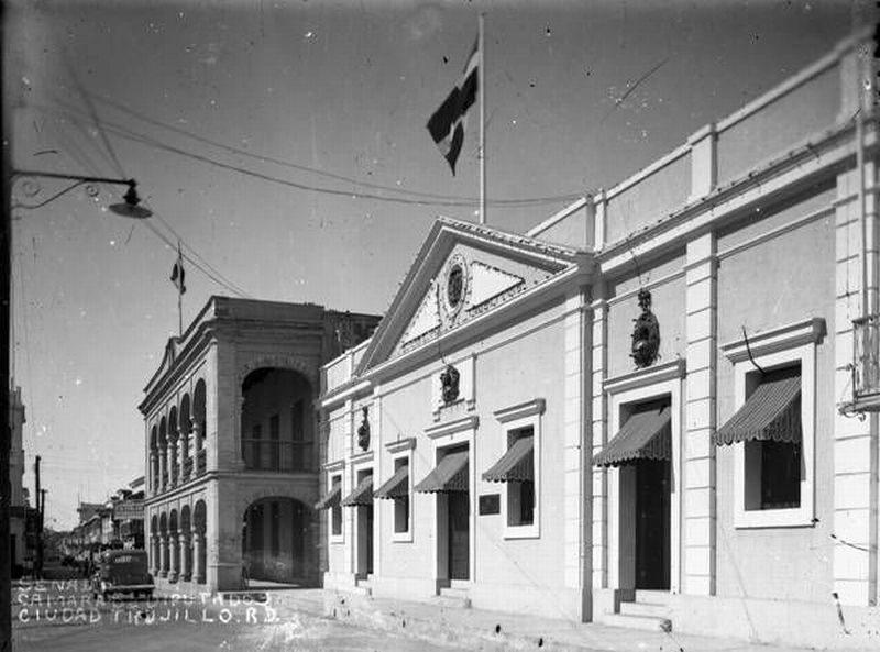
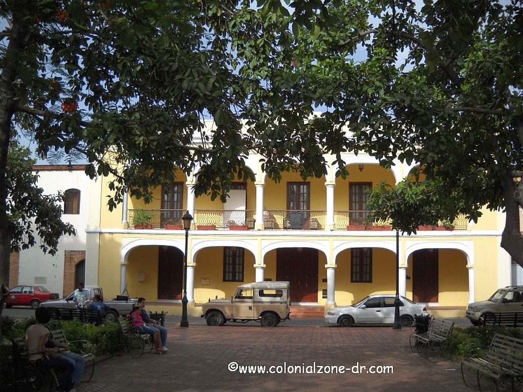
The Palace of Borgellá is a beautiful 2 story building noted for its large colonial style arches and old Caribbean flair. This building, with its affluent style, was built in 1823 by Haitian Governor Gerónimo Borgellá.
Palacio de Borgella in the 1940s
Home of the Tribunal
In 1844 the building was the home of the Tribunal. Then from 1942 to 1960 was the seat of the Senate. In the 1940’s The Palacío was the government seat. The local men met here to relax and discuss the events of the times. It was also used as the location of the Haitian Government when they took over the country.
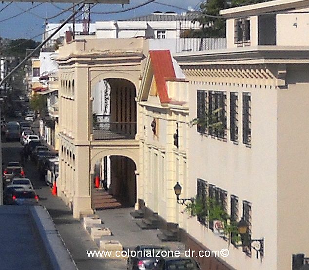
Palacio de Borgellá
This building was badly damaged during hurricane George in September 1998. It lost the front porch, which collapsed, and much of its facade. It has been completely restored.
Palacio de Borgellá. The location of the Colonial Zone Post Office.
This colonial building now houses the seat of the Patronage (who also takes care of the maintenance of the Colonial Zone), the Post Office and other offices.
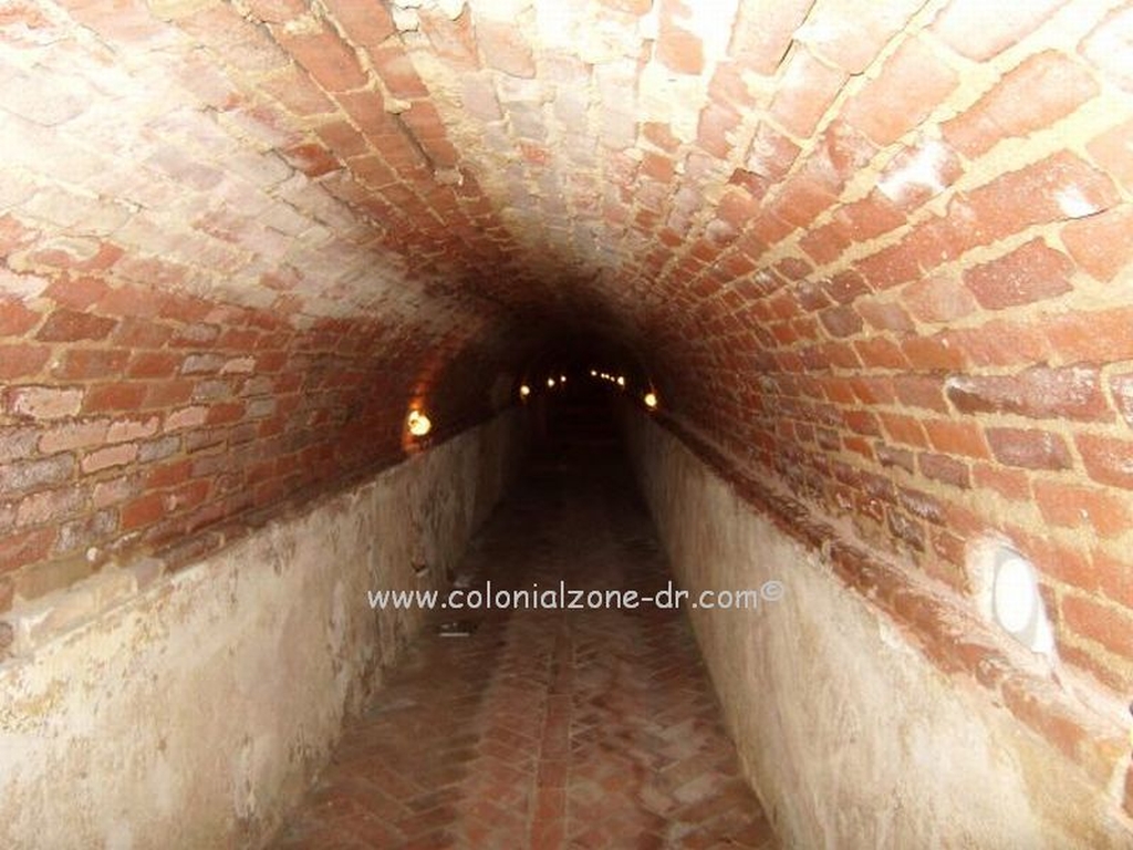
Buried beneath the colonial city is a very important historical sight. The first hydraulic sewage system from the Colonial period. These culverts are one of the firsts of the Americas. It is a UNESCO World Heritage Site.
These culvert tunnels are said to have run from Calle Restauración to the Santo Domingo Port. The tunnels zig-zag under the streets, businesses and homes in the old part of the city of Santo Domingo. They were not only used to move debris but also humans, animals and military unseen and undercover throughout the city.
Some of these tunnel systems were used for military purposes. Moving items and men, unseen, from place to place. It is claimed that there was a human moving tunnel that went from Parque Independencia to the Cathedral of Santo Domingo.
I was told that there was once, and maybe still is, an operating tunnel that connects the Cardinals’ quarters across from the Casa de Sacramento to the Cathedral. This way the Cardinal does not need to cross the street and he can move easily from home to church.
Construction of the first culvert began in 1502. It was named la Alcantarilla de Ovando/ The Ovando Culvert. This was the works for the entire southern part of the city. The construction was very crude and all the waste dropped directly into the river.
Alcantarilla Colonial tunnels under the Colonial City of Santo Domingo
Building the second part of this system started in combination with the construction of the Atarazanas (Shipyards) in 1509. This second underground line was named la Alcantarilla de Atarazanas. The second culvert was a bit more advanced in its construction. This new line was built to move sewage, mainly animal debris, and did not drop into the river like the first line did.
Tunnel discovered under Calle Isabel la Católica
The culverts are constructed of brick and stone. There are a series of archways that, as the construction progressed, became more sophisticated. The changes in the way the tunnels were constructed are very noticeable.
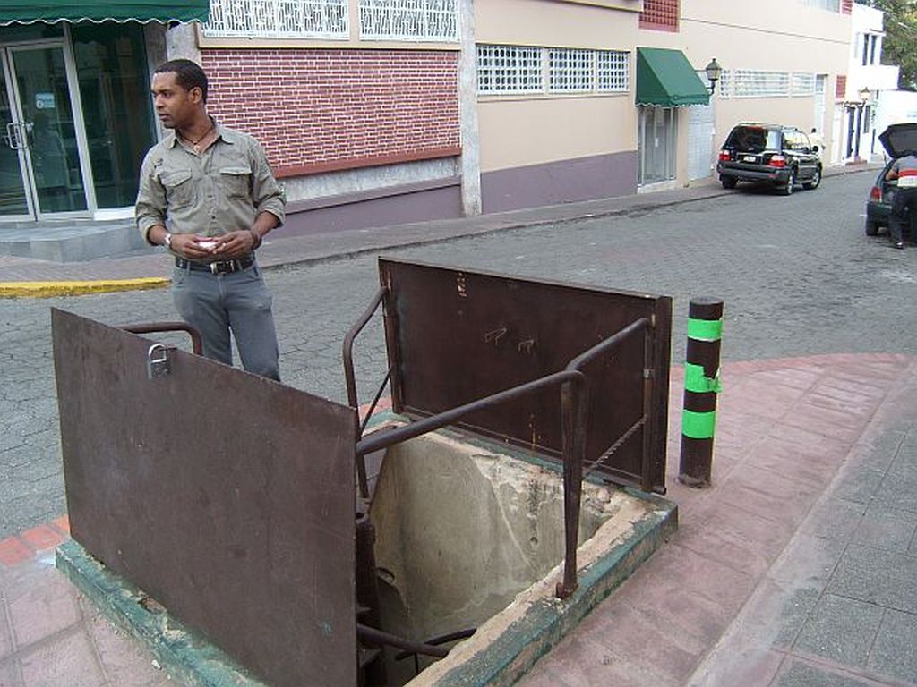
Most of these UNESCO Historical Site tunnels have long ago collapsed or been destroyed because of city construction. There are a few that still remain intact. When they were doing the Colonial Zone renovation in 2014 some of these tunnels were discovered under the streets of the city. They were explored and conserved before they replaced the streets that cover these historical sites.
Entrance to the culverts on Calle Isabel la Catolica
One of these tunnels has been kept up so people can see and walk through a small section. The entrance to this culvert underground tunnel is located outside of the Museo del Ron y la Caña. It is on Isabel la Católica street turning north from Colon Park. You need to ask inside the Museum about visiting the site.
All You Want To Know About The Oldest City In The Americas