Tag Archives: walled city

Northern Walls of Colonial Santo Domingo

The Northern Walls and Forts of Colonial Santo Domingo / Las Murallas y Los Fuertes del Norte de Colonial Santo Domingo

The walls of the north side of the old city of Santo Domingo are all but lost with a few small exceptions. From Fuerte Santa Bárbara and the battery of the Angulo, on the eastern edge of the colonial city along Rio Ozama, and Fuerte la Concepción, on the westernmost part of the city, little remains of the original Forts of Santo Domingo.

Fuerte de San Antón | Fuerte de San Francisco | Fuerte de San Miguel | Fuerte de San Lazaro | Fuerte de la Caridad

Most people visiting the Colonial City think that the walls surrounding the city only ran along the waters’ edge, the Caribbean Sea and up to Rio Ozama. But, there was more to protecting this important Colonial City than that. Many of the attacks on the city of Santo Domingo came from the land surrounding the city. The walls and forts were needed to protect the city from land attacks as well. This is why the entire city was surrounded by walls and forts.

It is sad to think that much of the history and these forts along the north side of the Colonial City are destroyed. Their walls are either destroyed or hidden behind modern buildings and forgotten.
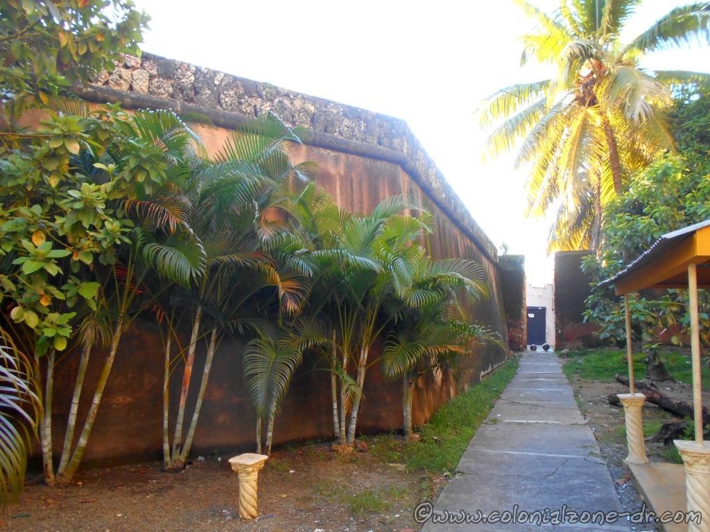
The wall of Fuerte San Antón from Av. La Mella entering into the Colonial City

These lost, or almost lost Fuertes/Forts and Murallas/Walls (east to west) are Fuerte San Antón, Fuerte de San Francisco, Fuerte San Miguel, Fuerte San Lázaro and Fuerte de la Caridad. It is easiest to see these walls walking from the Barrio of Santa Bárbara along Av. La Mella, crisscrossing between the streets of Duarte, General Cabral, Juan Isidro Pérez all the way down to Palo Hincado. (You can check the old html – nonresponsive map of the Colonial Zone and see the locations of these walls.)

Fuerte de San Antón
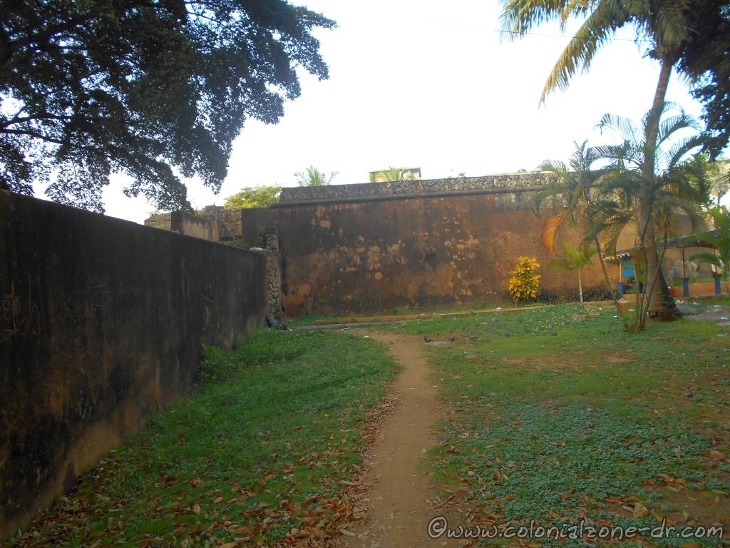
The wall of Fuerte San Antón accessed by Av. La Mella

Designed by J. B. Ruggero in 1672, it is one of the seven bastions surrounding the city in the north. It was not in the best location at the bottom of a hill so it was rebuilt many times. The Ermita de San Antón sits along this wall at the Plaza San Antón. The catwalk is still visible on the top of the mural. It can be seen at the beginning of Santa Bárbara and behind the small chapel, Ermita de San Antón.
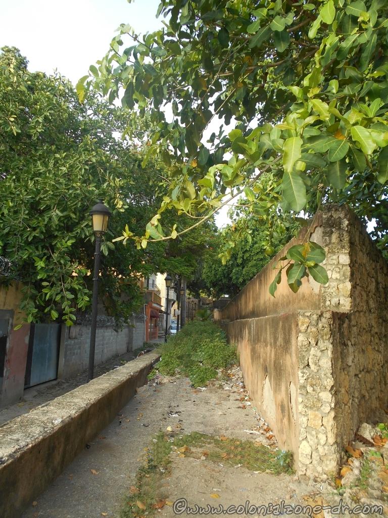
The catwalk along the top of the wall of Fuerte San Antón

Directions: Hostos and General Cabral along Ave. Mella

Fuerte de San Francisco
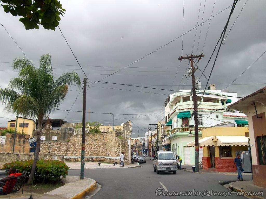
Calle Jose Reyes and Restauracion the start of the Muralla of Fuerte San Miguel

Located between the Forts of San Miguel and Ermita de San Antón, there is nothing left of this fort but a few small traces. Its wall, at one time, connected chapel or Ermita de San Antón and Ruins of the San Francisco Monastery. The fort was demolished at the end of the 19th century.
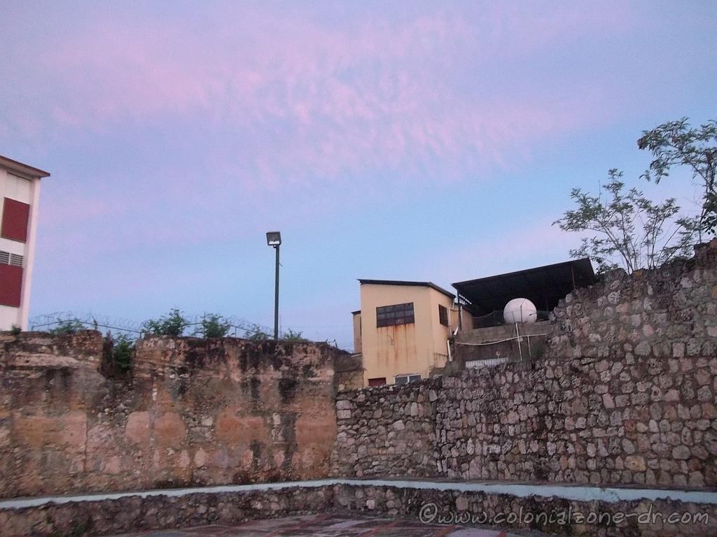
Fuerte San Miguel Calle Jose Reyes and Restauracion

Directions: Duarte and Vicente Celestino Duarte and General Cabral and Avenue Mella

Fuerte de San Miguel
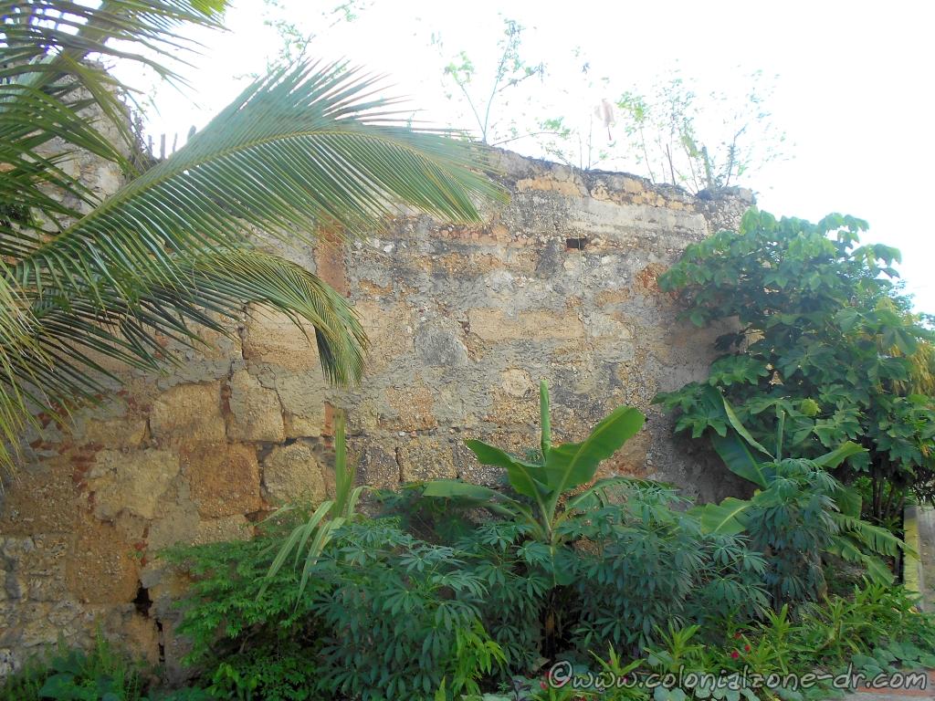
The Murallas of Fuerte San Miguel

Located in front of the church of San Miguel. All that is left of this fort is a wall that is in bad decay. More information about the Iglesia San Miguel.

Directions: Juan Isidro Pérez and José Reyes

Fuerte de San Lazaro

Calle Restauracion with the Fuerte San Lazaro in the distance

Constructed at the end of the 17th century using a pentagon shape. It is the only fort that has a strong double ramp leading up to the fort. This is very unique and is the only stronghold that has this type of incline. More information about the Iglesia de San Lazaro.

Fuerte San Lazaro with its unique double ramp

Directions: Juan Isidro Pérez coming in from Santomé and José Reyes

Fuerte de la Caridad/ Fort of Charity
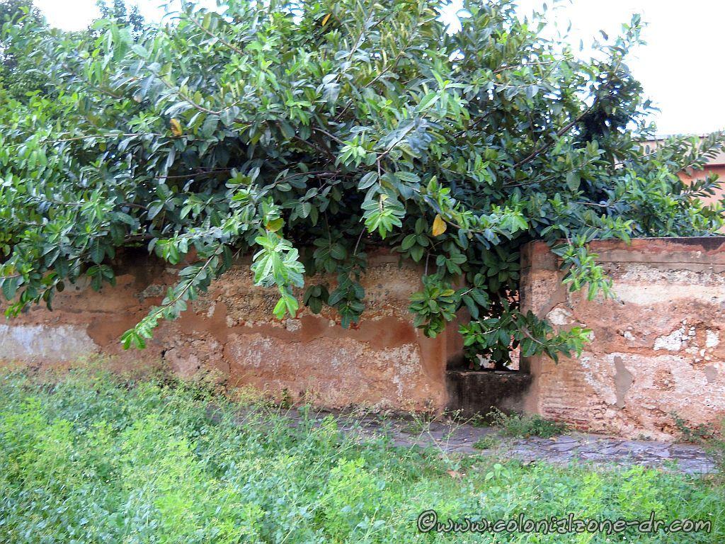
Atop the Fuerte San Lazaro has the openings for cannons

Fuerte de la Caridad is part of the northern section of the wall, built in the late seventeenth century. It can be seen in ruins hidden behind some buildings.

Directions: Juan Isidro Pérez #215 and Mella
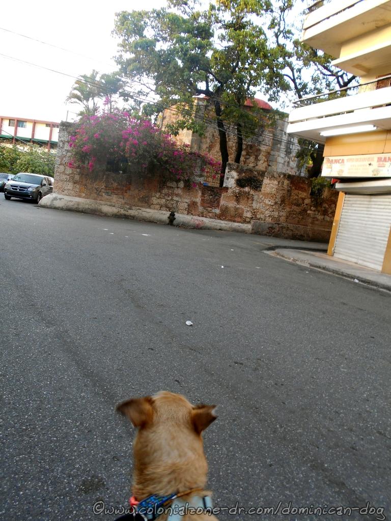
Part of the wall at Fuerte San Lazaro leading to Fuerte de la Caridad

Walk The Wall Tour

These forts and walls are a much-overlooked part of the Colonial City. To understand the history of this important colonial city I suggest that when visiting that you “Walk The Wall” as I call it. I do a tour where we walk the wall and just talk and enjoy the less-visited parts of the city. The tour is very casual and leisurely. At your pace and see what you are interested in seeing. If you are interested please email me at jan@colonialzone-dr.com

Puerta de la Misericordia

Puerta de la Misericordia / Door of Mercy

The Puerta de la Misericordia, originally named Puerta de Santiago and Puerta Grande, was the first fortified gate of the city of Santo Domingo. The lone wall was once part of the original wall that ran along the edge of the First city in the Americas, from Puerta del Conde (Parque Independencia) to Fuerte San Gil at the edge of the sea.

Announcing Independence February 27, 1844 | The Statue of General Matías Ramón Mella

Puerta de la Misericordia panoramic view in  2013
Puerta de la Misericordia panoramic view in 2013

The door was designed by the architect Rodrigo de Liendo and constructed in 1543; the bulwarks were added in 1568. In the colonial period, the gate served as access to the great plains of the south. The wall was connected to and protected by the military of the Fuerte de San Gil which is located just a few hundred feet south at the shore of the Caribbean.

Puerta de la Misericordia panoramic with the flag of Dominican Republic flying proudly above.

The gate received its current name, Puerta Misericordia (Gate of Mercy), in 1842. At this time the survivors of the many earthquakes and storms that occurred on the island gathered here to place the Blessed Sacrament thanking God for his mercy.

Puerta de la Misericordia in the early morning.

Announcing Independence February 27, 1844

The Puerta de la Misericordia is the place that Ramón Matías Mella fired his legendary blunderbuss (a muzzle-loading firearm) of February 27, 1844, to announce the independence of the Dominican Republic from Haiti after taking back the Fortaleza Ozama. At the same time of this shot, Francisco del Rosario Sanchez hoisted the Dominican flag in the Fortaleza.

Puerta de la Misericordia look out tower accessed by the catwalk.

Interesting Facts

*Near the door is a courtyard that held a scaffold used to execute those who were condemned to death. At one time there was a small chapel located in the courtyard.

*During the archaeological excavations in 1980, two small fortines (semicircular forts) that once flanked the walls were discovered.

*Located in the small plaza is a statue of Ramón Matías Mella, one of the Founding Fathers of the country.

The statue of Ramón Matías Mella at the Puerta de la Misericordia

The area surrounding the gate is now a nice little place to visit. You can sit and enjoy the view of the Fort San Gil and the Caribbean Sea located across the Malecon. There is also a Colmado across the street where you can get a little refreshment after walking around the Colonial City. You can notice that there is a catwalk over the top of the wall but it is blocked. Some of the original wall has been cut to make room for the street to pass making accessing the walk difficult.

The view of the Gate of Mercy from Calle Padre Billini with Palo Hincado passing in front.

Directions:

From The Calle el Conde at Parque Independencia walk towards the sea on Calle Palo Hincado the street that separates Ciudad Colonial from Ciudad Nueva. Calle Arzobispo Portes stops at the door.

Plaza Patriótica at the Puerta de la Misericordia honoring General Matías Ramón Mella

The Statue of General Matías Ramón Mella

Plaza Patriótica / Patriotic Square
General Matías Ramón Mella
February 25, 1816 – June 4, 1864

Located in front of Puerta Misericordia was a bust statue Ramón Matías Mella, one of the Founding Fathers of the Republica Dominicana. It was replaced with a full body statue honoring the anniversary of Mellas birth.

Close up of the statue honoring General Matías Ramón Mella

The plaque on the statue monument reads:
En homenaje al Padre de la Patria,
General Matías Ramón Mella
Héroe de la Independencia y de la
Restauración de la República Dominicana,
considerado el más grande genio y
estratega militar dominicano
de todos los tiempos.
Político liberal. Independentista eterno.

(English translation)
In homage to the Father of the Nation,
General Matías Ramón Mella
Hero of Independence and the
Restoration of the Dominican Republic,
considered the greatest genius and
Dominican military strategist
of all times.
Liberal politician. Eternal independence.

CPEP
Comision Permanente / Permanent Commission
From Efemerides Patrias

Proyecto Patriótico de Cultura Cívica / Patriotic Civic Culture Project
Foundación Luces y Sombras

Bicentenario de su natalicio / Bicentennial of his birth
25 Febrero 2016

Gobierno Constitucional
Lic. Danilo Medina Sánchez
2012-2016

The bust of General Matías Ramón Mella what was replaced by the statue.

The bust of Sanchez that was replaced by the statue read:

Gobierno Constitucional
Dr. Leonel Fernández
2004-2008

Fuerte de la Concepcion

Fuerte de la Concepción

Fuerte de la Concepción was built later in the history of the Colonial City. The fort is located at a very strategic location along the farthest northwestern side of the walled city of Santo Domingo.

The Fuerte de la Concepción and the Puerta del Conde, Parque Independencia.

The fort was designed by Juan Bautista Ruggero in 1672 and was built in 1678. It was an important addition to the city of Santo Domingos protection.

The Fuerte de la Concepción look out tower facing the land.

The strategic location of this important fort was for the initial protection of Santo Domingo and helped to deter many attempted take overs of the capital by land. It was the only fort to look towards the very isolated areas of what is now San Carlos. This was a very strategic location because they were able to view problems coming from inside the island where as most of the forts looked towards the sea or river areas.

The Fuerte de la Concepción catwalk is overgrown with weeds.

Included in the Fuerte de la Concepción, which can still be seen to this day, was a very wide approach ramp for the cannons, the round watch towers and a catwalk around the wall. Gone are the ammunition storage and troop houses. Replacing them are fruit stands and vendors selling their wares.

The Fuerte de la Concepción has not been taken care of very well.

Interesting facts:

*The fort area was used as a tram station from 1884 to 1904 when the fort was completely destroyed in a fire.

*The gate located in this wall is named Puerta de Lemba after a slave that was executed here.

*Fuerte de la Concepcion was where the people gathered when a natural disaster struck.

The Fuerte de la Concepción on Calle Palo Hicado as seen from Calle el Conde.

Location

: Calle Palo Hincado and Calle Las Mercedes. It is at the far end of the Colonial Zone across from Calle el Conde and next to Parque Independencia.