Rivers and Lakes. A refreshing leave from the city.
Lake Enriquillo/ Lago Enriquillo
This 13 mile long lake(approximately 300 km²) is in an out of the way area in the southwest,western part of the Hoya de Enriquillo, very near to the Haitian border. It is the lowest point in the entire Antillies, 114 feet below sea level . Lake Enriquillo is 3 times saltier than the ocean. It is a great spot to see crocodile (Caimans), flamingo, and iguanas.
The Isla Cabritos National Park is in Lago Enriquillo . This island has a very unique habitat. The original vegetation that once grew on this small island was lost to the goats and cattle that once grazed there and also due to the collection of timber. The new vegetation includes 106 species of plants, and 10 types of cactus. The area also boasts a large crocodile-caiman population. An endemic species of iguana along with other species of reptile populate the island. There are 62 different species of birds that have also been identified: five aquatic, 16 shore, and 41 land birds. 45 of these species are native to the island. Some of the birds included are the manuelito, the great hummingbird, the querebebé (which is best heard at sun down), and the cu-cú ( which sings at dawn and dusk, and nests in an excavated hole in the desert.
The Yaque del Norte is the most significant river in the country. Being about 296 kilometers long, it rises near Pico Duarte in the Cordillera Central. It empties into the Bahía de Monte Cristi on the northwest coast, where it
forms a delta.
The Yaque del Sur is the most important river on the southern coast. It rises at an altitude of 2,707 meters in the southern slopes of the Cordillera Central. The upper course flows through the mountains and is about 183 kilometers in length. The river forms a delta near its mouth in the Bahía de Neiba.
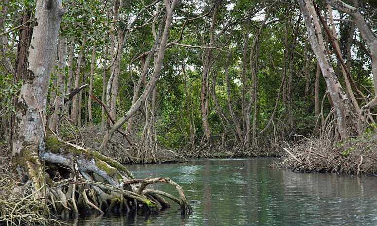
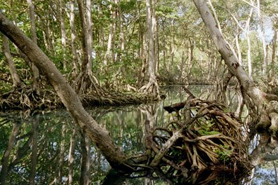
This Lagoon is near Playa Grande, about 1 hour east of Cabarete. Located near the fisherman's village of Rio San Juan. You can take a boat trip on the sweet waters of Gri Gri Lagoon.This is a fresh water lagoon with a mangrove forest forming a canopy over its various channels. A extraordinary ecosystem with a beautiful and breathtaking view of crystal clear green shimmering water as far as the eyes can see. There are beautiful reefs and groves spilling over with a vide variety of tropical birds. One can see vultures in the trees and tree frogs in the roots. The winding lagoon full of fish and even some piranha. This winding water way leads to a shallow cove with beautiful El Caletón Beach. It is unlike any other beach in the country. Coming onto this beach you enter through a stone arch on the reef. This cove has a crystal clear pool where you can enjoy a swim and some sun. There is a cave unique to the area located here also.
El Mangle restaurant is located on the lagoon. It juts out over the lagoon and is a great typical Dominican restaurant to visit while at the lagoon.
Also an excellent place to dive. Among divers this is said to be one of the better sights for diving. There are many excursions taking people out for a boat ride through the mangrove forest. There are also diving excursions that have some great reviews. Check out our pastimes-water_sports page (opens in new window) for information on dives available in Dominican Republic.
Lago Rincsn The island's largest freshwater lake is a popular place among bird watchers (info on bird watching tours).
Charon River This river is a popular boating destination for wildlife enthusiasts
Rio Ozama is the river that drains into the Caribbean Sea that divides Santo Domingo, the capital, in half. It is 148 kilometers long and starts in La Altagracia. This river is very polluted in many places. An aerial picture of the river (new window)
The Isabela, The Sabita, The Yabacao
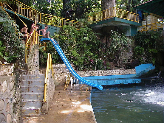
La Toma San Cristobal (about 20 miles north of Santo Domingo) – This is a river made into a bathing and swimming place. Trujillo built this place for his pleasure and it has been kept up very nicely. There is a slide and other water enjoyments. It is very refreshing. It is open to the public and there is a fee to swim here. It is not a private, relaxed swim usually. There always seems to be a bus coming in loaded with children coming to play in the river. Since this is where Trujillo was born his home and other buildings he had built can be seen here.
Gri-Gri Lagoon
The Lakes
Directions: Border of Haiti, Dominican Republic More about Lago Enriquillo
More information on the creatures of Dominican Republic

See our picture collection of Lago Enriquillo. Lizards, people of the area and some pictures of the lake itself.
|
|

site map Copyright © 2005 - 2014 All Rights Reserved. Colonial Zone-Dominican Republic (DR)
Home | Calendar | Night Life/Dining | Sight Seeing | Pictures | Businesses | Artists | Food | Helps | History | Language | Music | Media | Pastimes | Products | Tradition/Legend | Links | About Us | Buy Mamajuana | News Blog | DR Gringa's Life Blog | Dominican Dog Blog | Web Designer

Custom Search

Home | Dining & Night Life | Hotel | Sights | Pictures | Music | Colonial Zone Map | Hot Spots! Directory | Site Search


MENU
IN COLONIAL ZONE
THINGS DOMINICAN
If you found my web site useful please consider making a donation through Pay Pal . Thanks!

Our complete exchange rate tool.
Gracias a coinmill.com
Finding Something to Do in Dominican Republic | Shopping | Movies | Movie Theaters | Baseball | Dominoes | Cock Fighting | Golf | Boating/ Fishing | Water Sports | Adventure Sports/ Caving | Misc. Sports | Nature/ Eco Tourism | Gambling/ Racing | Beaches | Lakes/ Rivers | Parks and Plazas | National Parks and Reserves | Tourist Stuff | Tourist Cities | Drinking | Explore DR -Road Trips |
Rio San Rafael in Barahona
The cool water of this river running down from the hills in Baharona is a wonderful place to refresh yourself. The river running over the rocks enters a pool where people meet and greet. Then the sweet waters run into the Caribbean Sea. More information about what to do and where to stay in Baharona.
+click images to enlarge
The rivers in Dominican Republic are, in general, either short or intermittent. Even though people call these rivers cold, they are very refreshing sweet water.


.jpg)
.jpg)