Tag Archives: fort

Fuerte and Parque San José

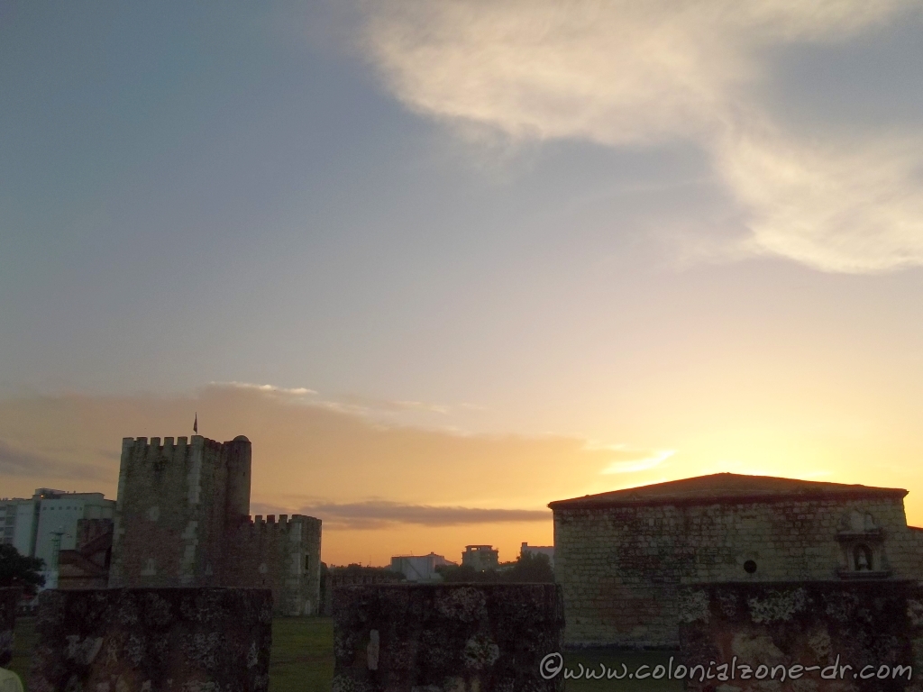
Fuerte y Parque de San José/ Fort and Park San Jose

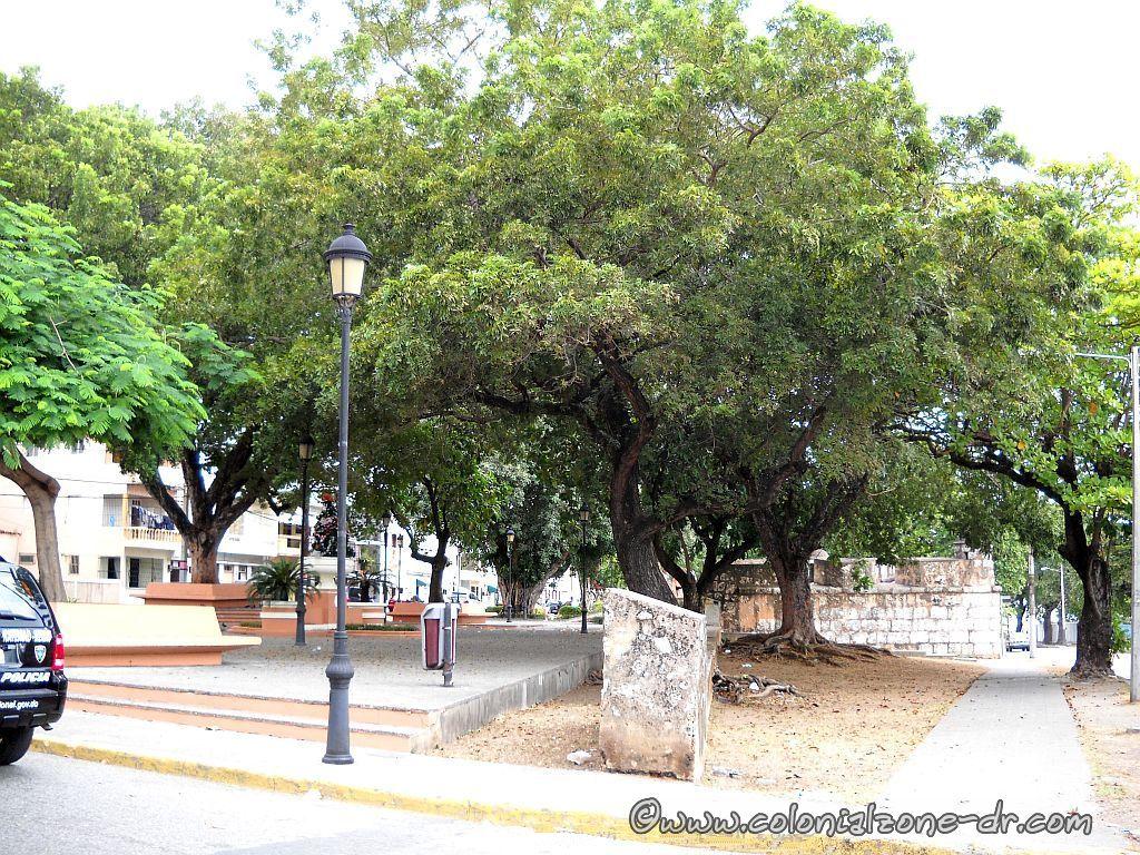
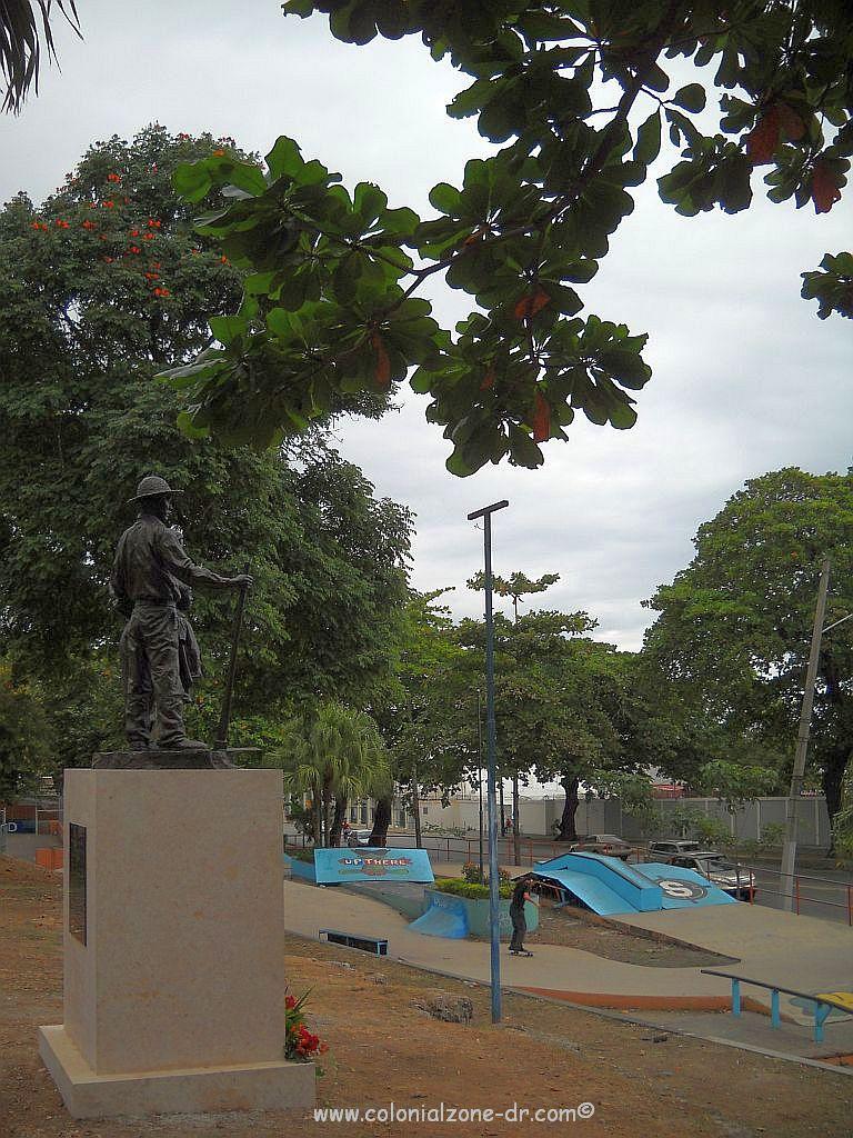
The Fuerte San José is a beautifully restored fort located in the historic Colonial City. The Parque San Jose is a well-kept park. It is the perfect place to relax. You can watch some young people do some skateboarding or enjoy a game of basketball all under the beautiful shade trees located throughout the park.

Fuerte San José | Parque San José | Location

Fuerte de San José, shooting platform, cannons and watchtowers with the view of the Monument Montecino.

The Fuerte San José

was part of a series of bastions built to defend the walled city of Santo Domingo in the 16th century. It was part of the walls that ran along the Caribbean Sea and was an important part of the protection from attacks by sea.

The rectangular shaped fort San José

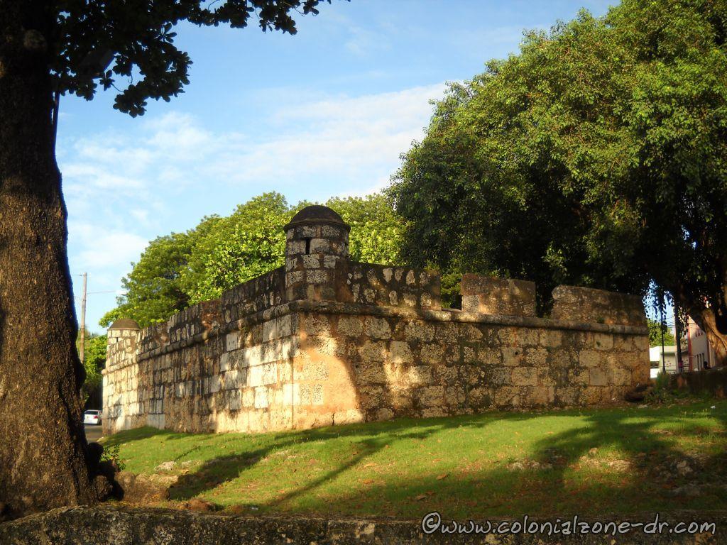
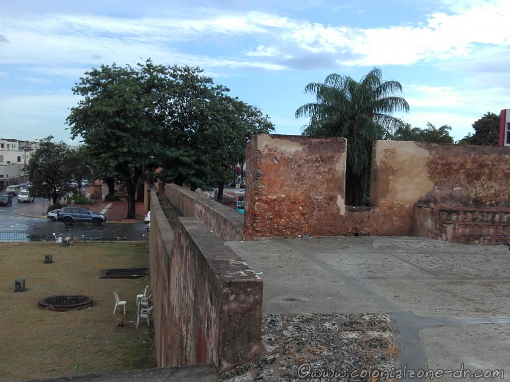
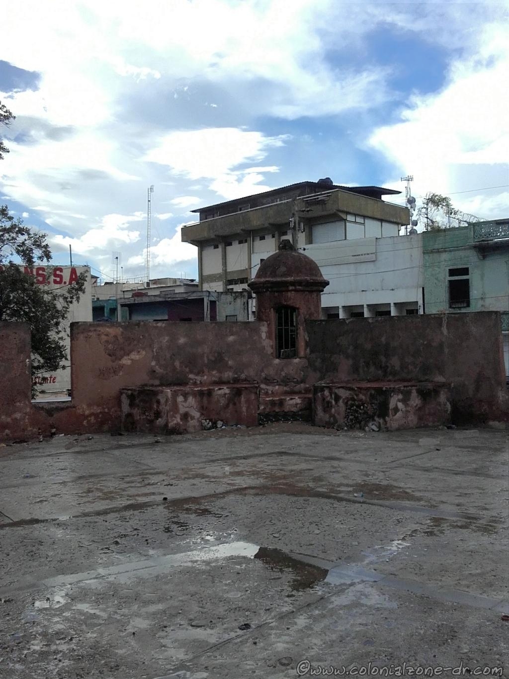
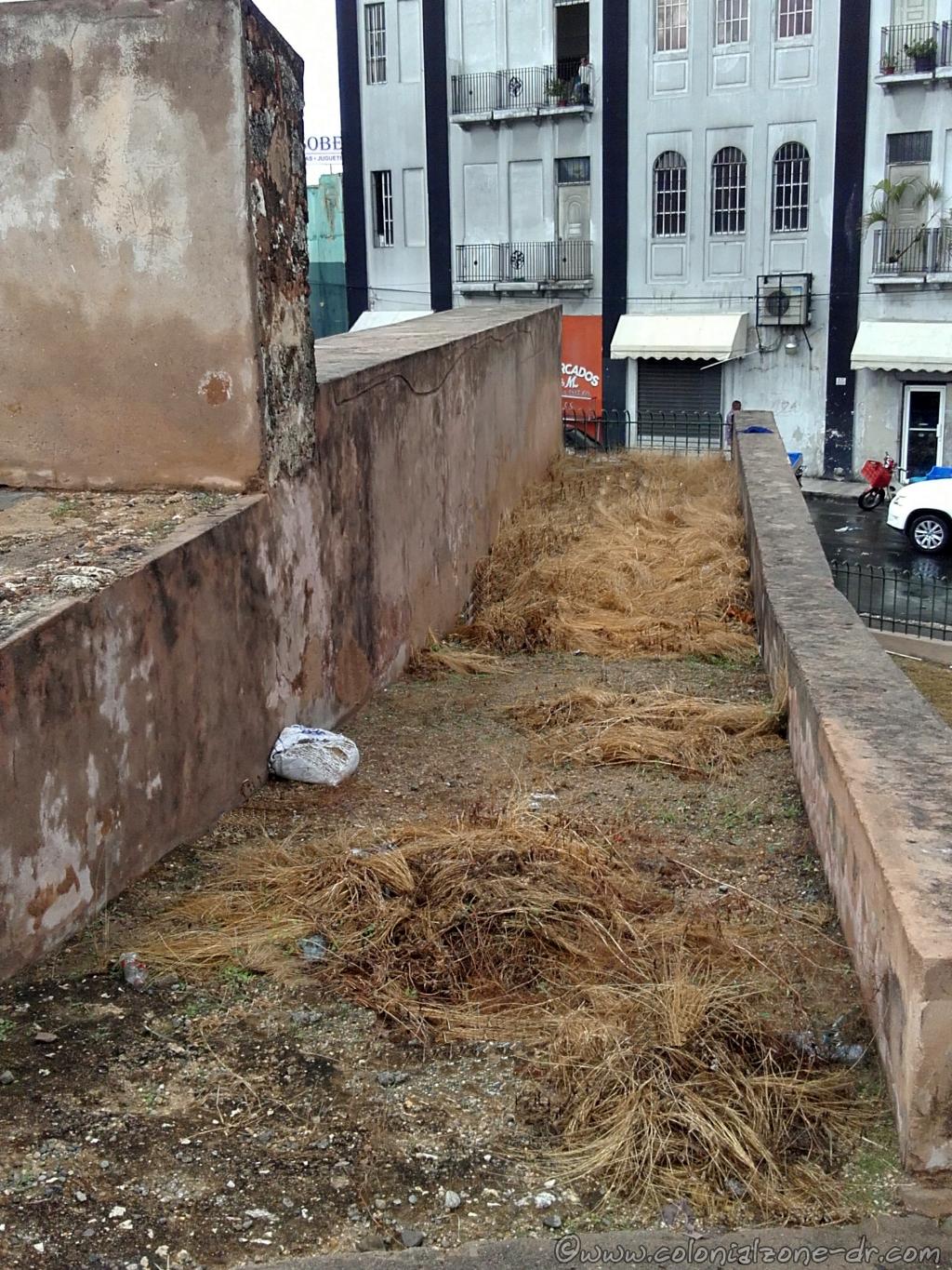
Fuerte San José was built near the mouth of the Rio Ozama. The strategic placement of this fort was to watch the comings and goings at the mouth of Rio Ozama. The rectangular shaped fort has an artillery platform that was equipped on 3 sides with cannons. Its two watchtowers (garitas redondas) lookout out points gave a great view of the surrounding sea and land. There was also a lighthouse located in the fort at the entrance to the Rio Ozama that guided ships into the mouth of the river.

Fort San José and the Faro (lighthouse) in the early 1900's.
Fort San José and the Faro (lighthouse) in the early 1900’s.

It is important to remember that the road (The Malecon / Av. George Washington) in front of the fort did not exist at that time. It was built later by President-Dictator Trujillo. During the time of the colonization of Santo Domingo the water came up to the walls of these seaside forts. Now the walls are surrounded by a road.

Looking to Fort San José from the front.

Construction of Fort San Jose began in the mid 1500’s and took over 2 centuries to complete. The walls were built first by president Alonso de Fuenmayor who had some serious money problems and could not complete construction. Finally, at the beginning of the 17th century, the wall of this important fort was finished. Finishing the wall ensured that the seafront was fully protected by connecting the forts San Gil, San Fernando, San Carlos, Santa Catalina to San José. San Gil and San José was the largest of these forts that provided the main defense of the city of Santo Domingo.

View of Fuerte and Parque San José from Calle 19 de Marzo

Parque San José

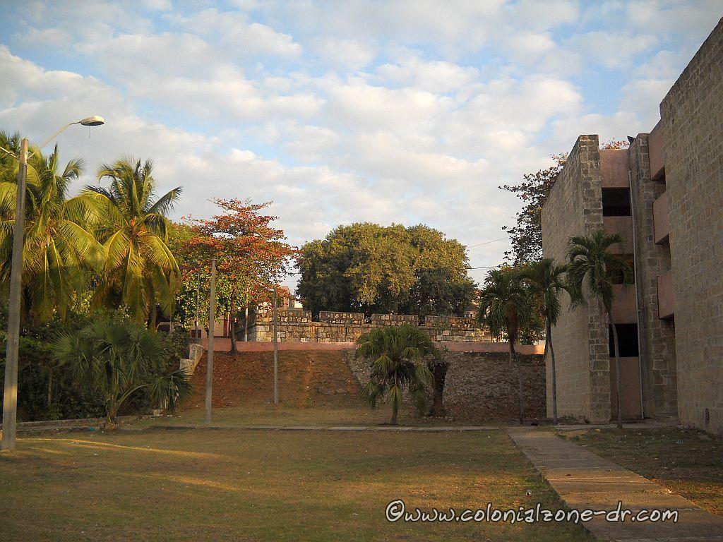
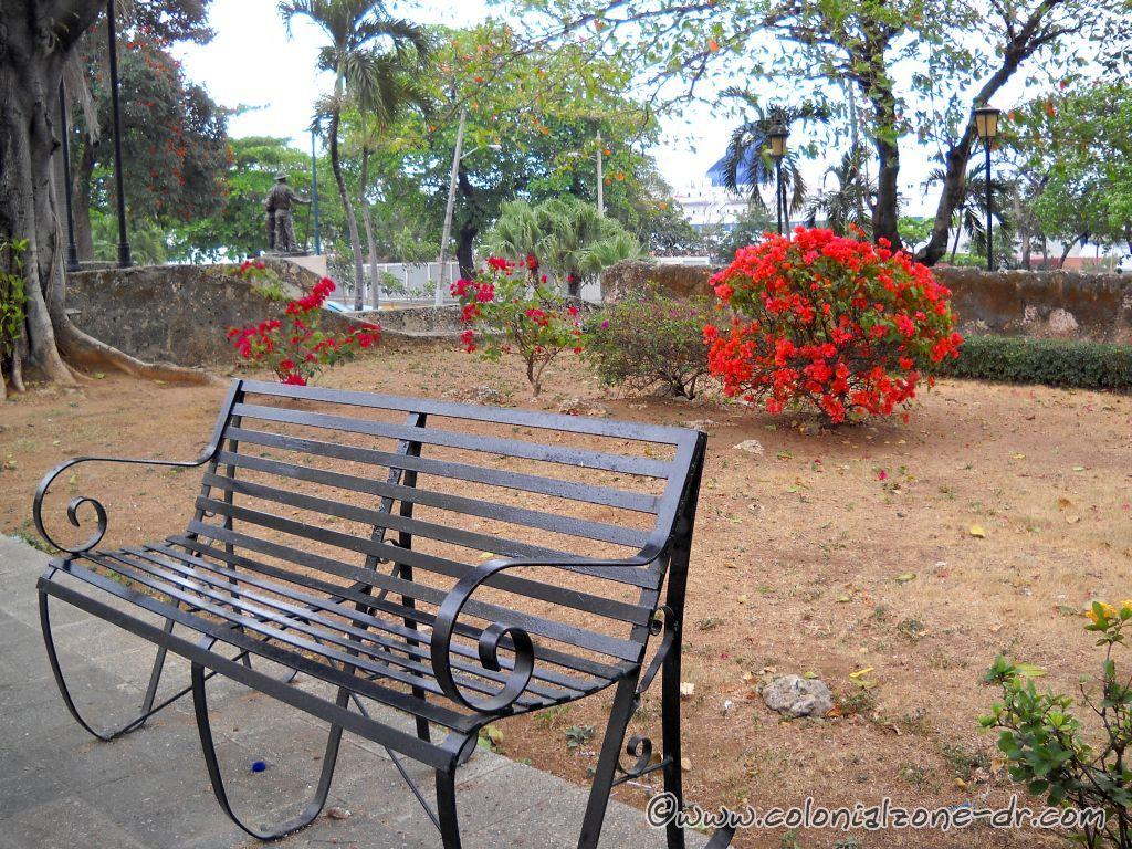
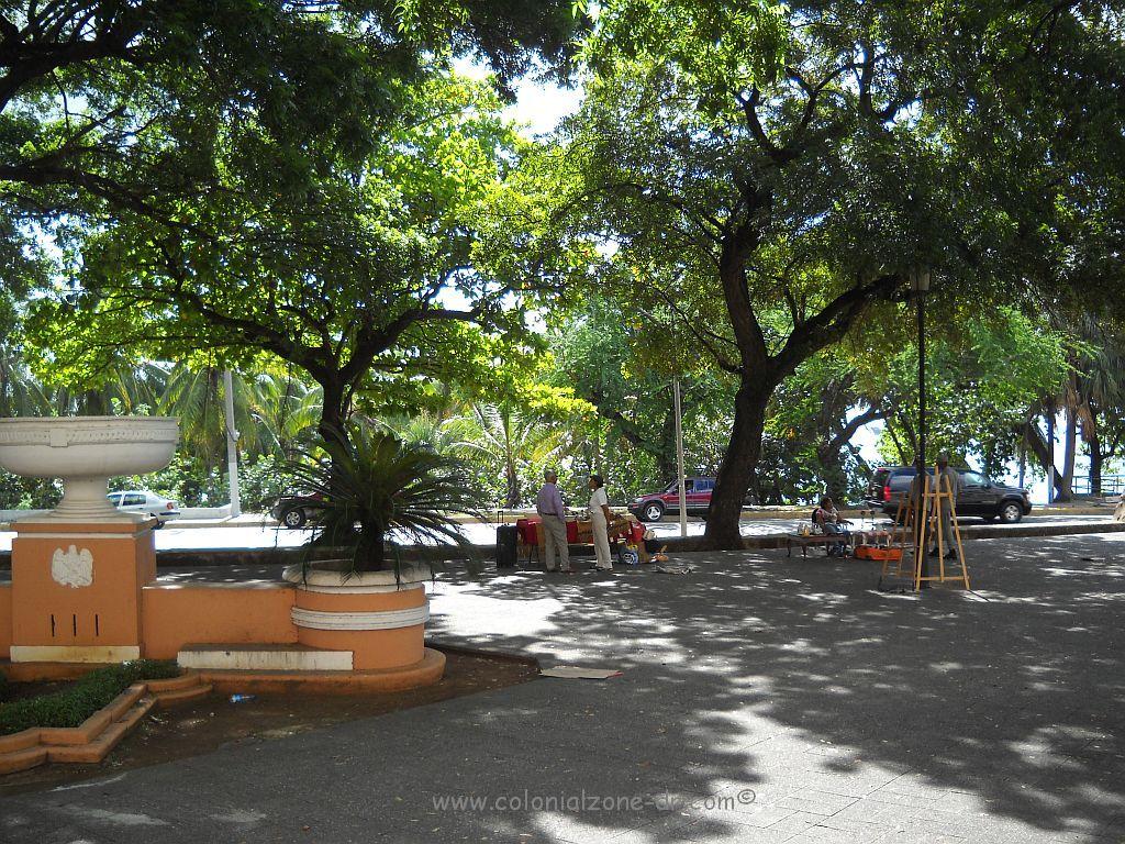
In the 1940’s the deteriorating fort was restored and a beautiful shaded park was created surrounding the bastion. Parque San José, also known as Parque Montecinos, is a place where locals like to gather to enjoy a time of rest and to visit friends and family. There are all types of nice places for you to sit and relax and enjoy the view.

Friends, family and pets enjoying the shade in Parque San José.
Parque San José. Relax and enjoy the view.
The view of Montecinos from Fuerte San José

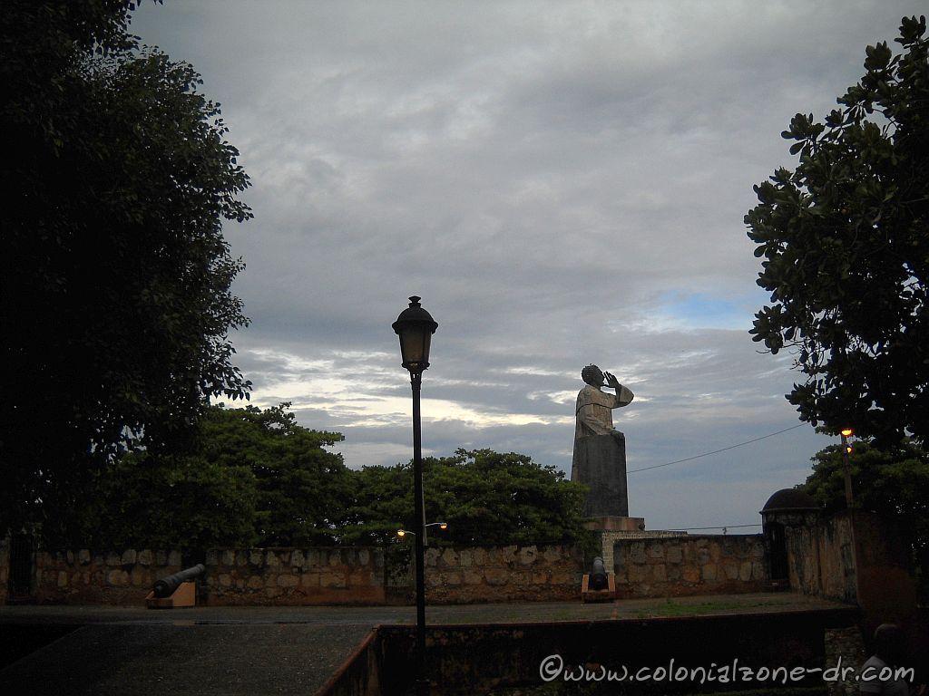
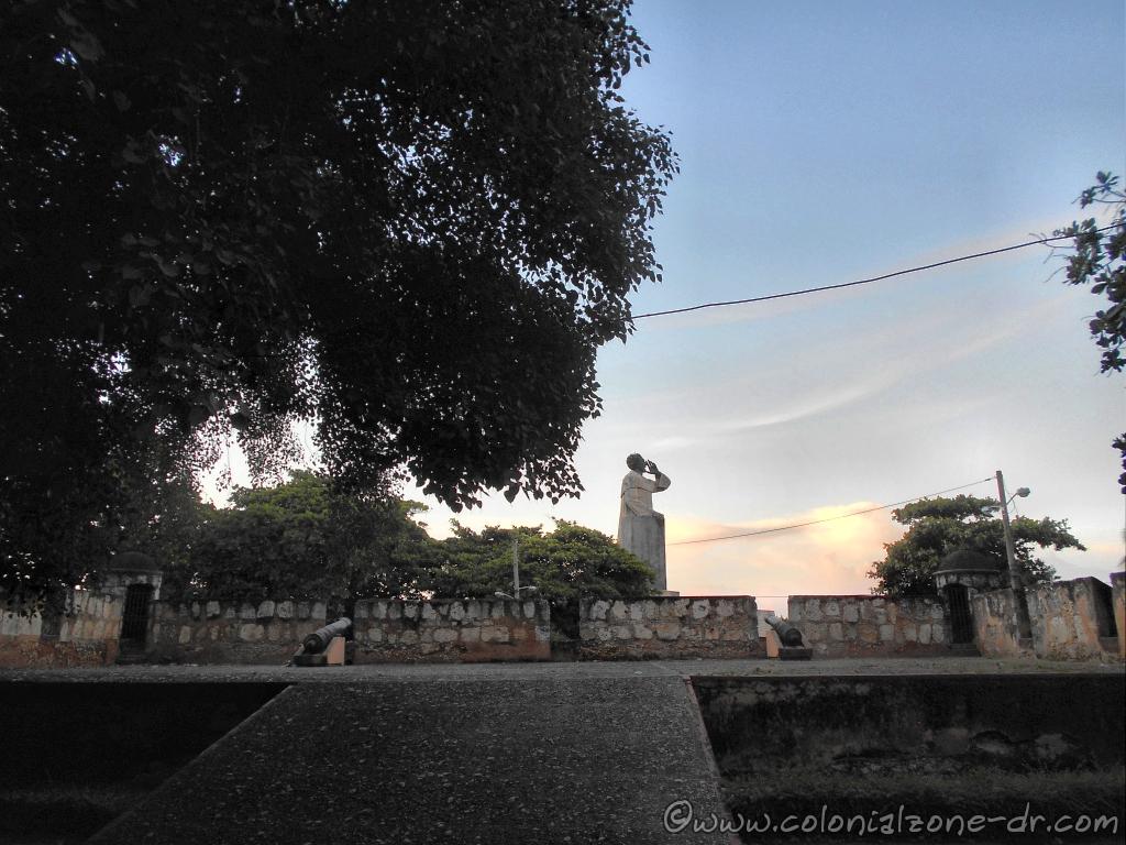
You can climb the shooting ramp to the elevated platform of the old Fort San José. Here you can have a perfect view of the statue of Fray Anton de Montecino.

Parque San José Ornamental Fountain

Located in the center of the larger part of the park is an Ornamental Fountain that the United States gifted to the Dominican Republic. It was placed here to mark the 100 year centennial anniversary of the country’s independence and the expulsion of the Haitian government from the country.

Fuerte San José and the Japanese Agricultural Immigration Monument and the Skateboard Park

Facing Ave. George Washington in the park is the Japanese Agricultural Immigration Monument. You can see this beautiful monument that symbolizes the arrival of Japanese Immigrants to Dominican Republic.

Fort San Jose Basketball court and Skateboard parks.

There is Montecino Skateboard Park in the Parque San José located on the Malecon near to Calle Arz Meriño. You can see many skate events or watch someone having a good time skating on the ramps and jumps of the park. You can always bring your board and have a go.

Under the street Jose Gabriel Garcia is The Cueva de las Golondrinas next to the Basketball Court

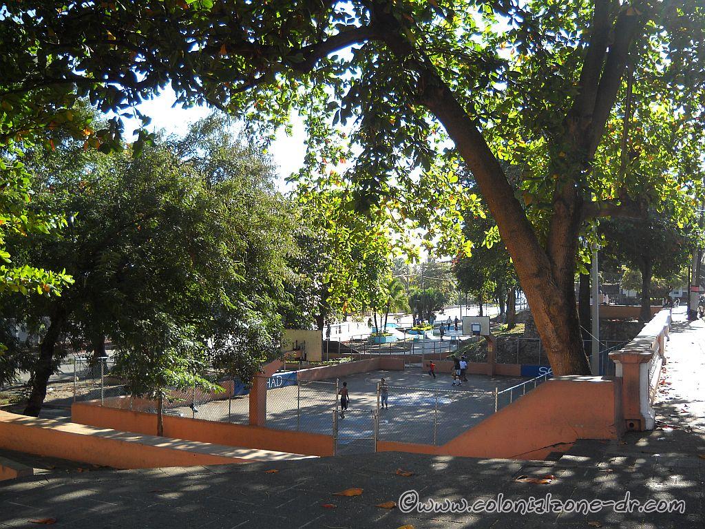
A Basketball Court is also located in the park on the corners of The Malecon, Calle Arz Meriño and Jose Gabriel Garcia where you can watch the game from above. If you go down to the court level there are small rooms under the street. This is known as The Cueva de las Golondrinas / Cave of Swallows. This is an underground storage place for equipment, street signs and there is a small police station.

Fortaleza and Parque San José along Calle Jose Gabriel Garcia.

Location:

From Calle El Conde walk towards the sea on Calle 19 de Marzo or Meriño to the Malecon. The Fort – Park is located between these 2 streets running along the Malecon in front of the monument Fray Anton de Montesino. Between Avenida George Washington (Paseo Presidente Billini – Malecon) and Jose Gabriel Garcia and Calle 19 de Marzo, Ciudad Colonial.

Fuerte de la Concepcion

Fuerte de la Concepción

Fuerte de la Concepción was built later in the history of the Colonial City. The fort is located at a very strategic location along the farthest northwestern side of the walled city of Santo Domingo.

The Fuerte de la Concepción and the Puerta del Conde, Parque Independencia.

The fort was designed by Juan Bautista Ruggero in 1672 and was built in 1678. It was an important addition to the city of Santo Domingos protection.

The Fuerte de la Concepción look out tower facing the land.

The strategic location of this important fort was for the initial protection of Santo Domingo and helped to deter many attempted take overs of the capital by land. It was the only fort to look towards the very isolated areas of what is now San Carlos. This was a very strategic location because they were able to view problems coming from inside the island where as most of the forts looked towards the sea or river areas.

The Fuerte de la Concepción catwalk is overgrown with weeds.

Included in the Fuerte de la Concepción, which can still be seen to this day, was a very wide approach ramp for the cannons, the round watch towers and a catwalk around the wall. Gone are the ammunition storage and troop houses. Replacing them are fruit stands and vendors selling their wares.

The Fuerte de la Concepción has not been taken care of very well.

Interesting facts:

*The fort area was used as a tram station from 1884 to 1904 when the fort was completely destroyed in a fire.

*The gate located in this wall is named Puerta de Lemba after a slave that was executed here.

*Fuerte de la Concepcion was where the people gathered when a natural disaster struck.

The Fuerte de la Concepción on Calle Palo Hicado as seen from Calle el Conde.

Location

: Calle Palo Hincado and Calle Las Mercedes. It is at the far end of the Colonial Zone across from Calle el Conde and next to Parque Independencia.

Fortaleza Ozama

The Fortress of Santo Domingo also known as Fortaleza Ozama

The Fortaleza Ozama is considered to be one of the oldest forts of its kind on the entire American continent. It was built between 1502 and 1508. Built with coral brought from the sea that were skillfully cut into blocks that fit tightly together. This fort extended from the eastern to the western bank of the Rio Ozama / Ozama River (Ozama is the Taino word for navigable waters or wetlands). It is one of the many UNESCO World Heritage Sites inside the Colonial City.

Sun Rise Over Fortaleza Ozama

Fortelaza Ozama | Fortaleza Ozama – Inside The Walls of Fortaleza Ozama | (1)La Puerta de Charles III/ The Gate of the Fortress | (2)The Statue of Oviedo | (3)The Tower of Homage/ Torre del Homenaje | (4)The Arsenal/ Armory Polvorín de Santa Bárbara | (5 & 6)The Low and High Shooting Platforms | (7)The remains of the First Fort/ Primera Obra | (8)Old Army Barracks | (9)The Fort of Santiago/ Fuerte de Santiago | (10)Casa de Bastidas | (11)Muralla de Felix Benito | Fortaleza Ozama in 1910 | Picture Collection over 300 pictures of the Fortaleza Ozama |

Map Inside Fortaleza Ozama Numbered 1

Map Inside Fortaleza Ozama Numbered 1

Governor Ovando

Governor Frey Nicolas de Ovando, the founder of the city of Santo Domingo, is the person who personally chose this spot for this military installation. The fort was built by the labor of the African and Taino slaves, as were most of the buildings of this era.

The strategic location of this fort gives it a perfect view of any ship or person trying to gain entry into the city of Santo Domingo. From high on the steep bank the fort overlooks both the Ozama River and the Caribbean Sea. This is where all the departures of the great expeditions to other regions of the Americas began. The strategic location was a perfect way to defend the city against attack by marauder and pirate, common occurrences at this time. The perfect placement of the fort made it a very formidable stronghold. It was never seized by force, even though many attempts were made. Considered to be “The Axis of the Conquest” Fortaleza Ozama was built by the Spaniards after they finished exploring the entire island.

Master builder Gómez Garcia de Varela was responsible for the building of this fort in all its stages. First was the erection of the tower. Then came the shooting platforms and the main defensive fort. As time passed new facilities were added and old ones modified as needed.

Etntrance To The Fortaleza Ozama

The Walls

The walls encompassing the fort are three meters thick with exception of the wall bordering the river. The river wall is only one meter thick. This was done so that if there was an explosion the wall would explode outward to the river. This restricted maximum possible damage.

The outer new wall, The Muralla de Felix Benito, was built when Port Santo Domingo and the sea road, the Malecon, was created. The dredge that was taken out of the port was used to make the land on which the highway now runs.

Visiting the Torre del Homenaje you will notice that it is very cool inside. This is because of the towers thick walls. This makes the climb to the top of the tower a pleasant experience even when done during the mid-day heat. The coral rock, which is what the buildings are made of, is a good moisture absorber. The cement holding it all together was made of gypsum, clay, lime and the blood of animals. This strong cement became stronger as time went on.

The Back Gate Wall of Fortaleza Ozama

Fort Ozama was used as a prison up to the 1960s. It housed many of the Dominican Republics’ political prisoners as well. In the 1970s the fort was retired from military service. At this time the fort was restored and opened to the public.

In the outside wall of Fortaleza Ozama hear the main entrance is a Cannonball embedded in the wall.

Visiting Fortaleza Ozama

When visiting the fort be sure to take some time and walk the grounds to see the entire fort. Walk the perimeter of the wall that is lined with cannons. At the far corner of the back wall is an old look-out tower that has a Gothic feel. If the gate is open you can go down the old ramp to the lower shooting platform. If your visit coincides with mango season you might be able to pick a mango off one of the many trees along the back wall.

A few times I walked and took my time I found pieces of pottery and porcelain that are very old and I was told some pieces are from Portugal. Some pieces match the styles in the Museo of Casa Reales.

Sherd of history on the dirt  inside Fortaleza Ozama.
Sherd of history on the dirt inside Fortaleza Ozama.
Sherds from old pottery found on the grounds of the Fortaleza Ozama

Tour guides hang out at the gate if you would like a guided tour. You can go on unguided but a guide can explain so much of the history it is worth the small price you will pay. It costs $60 pesos per person (RD$20 for students and children) to enter and about $300 for a guide to take you, more or less. (price as of 5/2013)

The Entrance To Fortaleza Ozama on Calle Las Damas

Location

Located on Calle Las Damas and Calle Pellerano Alfau, Zona Colonial, Santo Domingo. Walking on Calle el Conde towards the river take a right onto Calle las Damas and it will be about 1 block down on the left.
Telephone: 806-686-0222

See the picture slideshow of the Fortaleza Ozama. Picture Collection over 300 pictures of the Fortaleza Ozama

Continue to the 2nd page – Fortaleza Ozama – Inside The Walls of Fortaleza Ozama